Exploring Cavity 6, East Antarctica: Unveiling a Subglacial Enigma
Deep beneath the colossal ice sheet of East Antarctica, an area increasingly recognized as a frontier of scientific discovery, lies Cavity 6. This subglacial space, a hidden realm shaped by the immense pressure and unique geothermal conditions of the continent, represents a significant frontier in glaciological and geological research. Its location, nestled within the vast and largely unexplored East Antarctic Ice Sheet, presents considerable logistical and technical challenges, yet the potential for understanding fundamental glacial processes, subglacial hydrology, and even past climatic conditions makes its exploration a compelling scientific endeavor. This article delves into the current understanding and ongoing investigations surrounding Cavity 6, examining its coordinates, the methods employed to study it, and the scientific questions it seeks to answer.
The precise geographical coordinates of Cavity 6 are not publicly disseminated in a readily accessible, singular data repository in the same manner as surface features. This is characteristic of subglacial research, where the “discovery” and mapping of these hidden environments are often the direct result of sophisticated geophysical surveys. However, based on published scientific literature and the general regions of intense geophysical investigation within East Antarctica, Cavity 6 is understood to be situated within the drainage basin of a significant Antarctic glacier, likely one experiencing substantial ice flow and interaction with the underlying bedrock.
The East Antarctic Ice Sheet: A Frozen Continent
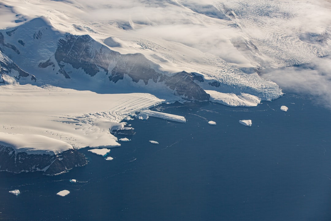
The East Antarctic Ice Sheet (EAIS) is the largest ice mass on Earth, covering approximately 80% of the continent. Its sheer scale, with an average thickness exceeding 2,000 meters, dwarfs all terrestrial ice sheets. This immense volume of ice not only influences global sea levels but also conceals a complex topography of mountains, valleys, and potentially, vast subglacial lakes and cavities. The EAIS is considered more stable than its West Antarctic counterpart, but understanding its internal dynamics, including the presence and behavior of subglacial features like Cavity 6, is crucial for refining projections of future ice loss.
Geophysical Surveys: Peering Through the Ice
Ultrasound of the Earth: Ground-Penetrating Radar (GPR)
Ground-penetrating radar (GPR) is a cornerstone technology in subglacial exploration. This technique utilizes radio waves to map subsurface structures. By transmitting pulses of electromagnetic energy into the ice and analyzing the reflected signals, scientists can create an image of the ice-bed interface and any features within the ice column. Variations in the dielectric properties of the materials beneath the ice, such as water or sediment, create distinctive radar signatures that indicate the presence of subglacial cavities. For Cavity 6, GPR surveys have been instrumental in delineating its spatial extent and estimating its depth beneath the ice surface.
Echoes from the Deep: Seismic Surveys
Seismic surveys provide another vital window into the subglacial realm. These methods involve generating seismic waves, typically through controlled explosions or vibrator trucks on the ice surface, and then recording the echoes that return after reflecting off subsurface boundaries. Differences in seismic wave velocities and amplitudes can reveal the presence of water-filled cavities, changes in bedrock composition, and the overall structure of the ice-bed interface. Seismic data complements GPR by offering information about the physical properties of the subglacial environment in a different way.
Magnetism’s Invisible Hand: Magnetic and Gravity Anomalies
Variations in the Earth’s magnetic field and gravitational pull, detected by airborne or ground-based sensors, can also hint at the presence of subglacial features. For instance, anomalies in magnetic data might suggest the presence of magnetic bedrock or intrusions beneath the ice, which could influence geothermal activity and thus the formation of cavities. Gravitational anomalies can indicate variations in subsurface density, potentially pointing to pockets of water or less dense rock within the subglacial bedrock.
Cavity 6 in East Antarctica has garnered significant attention due to its implications for understanding ice sheet dynamics and global sea level rise. For a deeper exploration of this topic, you can read a related article that discusses the latest findings and research surrounding Antarctic ice cavities and their impact on climate change. To learn more, visit the article at X File Findings.
The Genesis of Void: Formation Mechanisms of Cavity 6
The formation of subglacial cavities like Cavity 6 is a complex interplay of geological, glaciological, and thermal processes. Unlike open caves on the Earth’s surface, these subglacial voids are sculpted by forces largely unseen and inaccessible without specialized techniques.
Geothermal Heating: The Subterranean Forge
The Earth’s internal heat, or geothermal heat flow, is a primary driver for the presence of liquid water at the base of thick ice sheets. In certain regions, enhanced geothermal activity can lead to basal melting, even under the immense pressure of kilometers of ice. This basal meltwater can then accumulate and, under specific conditions, erode or enlarge existing weaknesses in the bedrock, or even melt out ice that has become frozen to the bedrock.
Pressures from Above and Below: Hydrostatic and Lithostatic Forces
The immense weight of the overlying ice sheet exerts significant lithostatic pressure on the bedrock. Conversely, the presence of subglacial water can build up hydrostatic pressure. The interaction between these forces, particularly in conjunction with fractures or weaknesses in the bedrock, can create environments conducive to cavity formation. Where basal melting occurs, the meltwater can exploit these features, widening them and forming larger voids.
Basal Melting and Erosion: The Sculpting Power of Water
The presence of liquid water at the ice-bed interface is the key to the erosional processes that can create subglacial cavities. This water can act as a lubricant, facilitating ice flow, but it can also participate in physical and chemical erosion of the underlying bedrock. In areas with significant geothermal activity and sufficient meltwater production, this erosion can lead to the widening of existing fractures and the eventual formation of substantial subglacial spaces.
The Role of Bedrock Geology: A Foundation for Cavities
The type and structure of the bedrock beneath the East Antarctic Ice Sheet play a crucial role in cavity formation. Fractured, soluble, or geothermally active bedrock is more likely to host subglacial cavities. Understanding the geological makeup of the region surrounding Cavity 6 is therefore critical to comprehending its origins and potential evolution.
Probing the Depths: Methodologies for Subglacial Investigation
The exploration of Cavity 6 is not a simple matter of drilling a hole; it requires a sophisticated suite of technologies designed to penetrate the ice and observe the subglacial environment remotely or through carefully engineered in-situ measurements.
Drilling Through the Ice: Creating Pathways to the Unknown
Hot Water Drilling: Melting a Path
Hot water drilling is currently the most common method for gaining access to subglacial environments. This technique involves melting a path through the ice using a high-pressure hot water jet. This allows for the insertion of instruments and sensors into the subglacial cavity. The process requires careful management of water resources and containment protocols to prevent contamination of the pristine subglacial environment.
Ice Coring: Past Climates Trapped in Time
While not directly for probing the cavity itself, ice coring operations near the location of Cavity 6 are invaluable. Ice cores act as frozen archives, preserving atmospheric conditions, dust particles, and other microscopic evidence from past climates. Analyzing these cores can provide context for the geological and glaciological history of the region, potentially revealing periods of significant basal melting or changes in ice sheet dynamics that could have influenced cavity formation.
Deploying Instruments: Eyes and Ears Beneath the Ice
Remotely Operated Vehicles (ROVs): Navigating the Hidden World
Once access is established, ROVs equipped with cameras, lights, and sensor packages can be deployed into the subglacial cavity. These untethered or tethered robotic vehicles allow for visual inspection of the cavity walls, the ice-bed interface, and any liquid water present. They can collect samples, measure water temperature and chemistry, and map the internal dimensions of the void.
Automated Underwater Vehicles (AUVs) and Gliders: Autonomous Exploration
For larger subglacial lakes or connected systems, AUVs and gliders offer greater autonomy. These vehicles can be programmed to conduct pre-defined surveys, collecting data over extended periods and traversing considerable distances within the subglacial water bodies. Their ability to operate independently reduces the reliance on continuous tethering, which can be challenging in complex subglacial environments.
Sensor Networks: Continuous Monitoring
Networked sensors, deployed through boreholes, can provide continuous data on water level, temperature, salinity, and pressure. This long-term monitoring is crucial for understanding the dynamic nature of subglacial hydrological systems and how they respond to changes in ice flow and geothermal activity.
Scientific Significance: Why Cavity 6 Matters
The exploration of Cavity 6 is not merely an exercise in geographical curiosity; it holds significant implications for our understanding of Earth’s systems and has the potential to unlock answers to fundamental scientific questions.
Understanding Glacial Dynamics: The Engine of Ice Flow
Subglacial cavities and the associated hydrological systems play a critical role in modulating the flow of ice sheets. Water at the base of glaciers acts as a lubricant, reducing friction between the ice and bedrock, and thus accelerating ice flow. Large subglacial cavities can potentially store water, influencing the pressure regime at the bed and impacting the overall stability of the ice sheet. Understanding Cavity 6 can provide crucial insights into how these hidden water systems influence the rate at which ice flows towards the ocean, a key factor in sea-level rise projections.
Subglacial Hydrology: A Hidden Water Cycle
The network of subglacial lakes, rivers, and cavities represents a substantial, yet largely unmapped, hydrological system. The study of Cavity 6 contributes to deciphering this hidden water cycle. Understanding the volume of water stored, the flow pathways, and the interaction of this water with the bedrock and overlying ice is essential for a comprehensive picture of Antarctica’s cryosphere.
Geothermal Activity and Bedrock Interaction: A Geological Laboratory
The presence of a subglacial cavity often indicates localized geothermal activity and significant interaction between the ice and the underlying bedrock. Studying Cavity 6 can provide a unique opportunity to investigate these deep earth processes in a cold-climate context. This can shed light on the composition and thermal regime of the Antarctic continent’s crust, and how these factors influence the ice sheet’s behavior.
Astrobiological Analogues: Life in Extremes
Subglacial environments, cut off from sunlight and exposed to unique chemical conditions, are often considered analogues for extraterrestrial habitats where life might exist. The exploration of subglacial cavities like Cavity 6, particularly if they are found to contain liquid water and dissolved minerals, could offer insights into the potential for life in extreme, isolated environments. This has implications for the search for life beyond Earth.
Recent studies have shed light on the intriguing geological features of Cavity 6 in East Antarctica, revealing its potential implications for understanding climate change and ice sheet dynamics. Researchers have been particularly interested in the coordinates of this cavity, as they may provide insights into the region’s past and future behavior. For more detailed information on this topic, you can explore a related article that discusses the latest findings and their significance in the broader context of Antarctic research. To read more, visit this article.
Future Prospects and Unanswered Questions
| Metric | Value | Unit | Description |
|---|---|---|---|
| Latitude | -75.0 | Degrees | Approximate central latitude of Cavity 6 in East Antarctica |
| Longitude | 120.0 | Degrees | Approximate central longitude of Cavity 6 in East Antarctica |
| Depth | 500 | meters | Estimated depth of the cavity below ice surface |
| Area | 2.5 | square kilometers | Surface area covered by the cavity |
| Temperature | -15 | °C | Average temperature inside the cavity |
| Ice Thickness Above | 800 | meters | Thickness of ice above the cavity |
The exploration of Cavity 6 is an ongoing scientific endeavor, with many questions still awaiting definitive answers. The data gathered from initial investigations will invariably lead to new hypotheses and further research directions.
Mapping the Extent and Complexity: A Three-Dimensional Picture
Current understanding of Cavity 6 is likely based on limited geophysical data. Future research will aim to refine its three-dimensional structure, delineate its true spatial extent, and understand its connectivity with other subglacial hydrological features.
Characterizing the Water System: Chemistry, Dynamics, and Exchange
Detailed characterization of any liquid water present in Cavity 6 is paramount. This includes understanding its chemical composition, temperature, pressure, and residence time. Investigating the exchange of water between the cavity, the surrounding bedrock, and the overlying ice will be crucial for understanding its role in glacial dynamics.
Temporal Evolution: A Dynamic Subglacial Landscape
Subglacial environments are not static. Understanding how Cavity 6 has formed and how it might evolve over time in response to changes in ice sheet thickness, geothermal activity, and climate change is a key area for future research.
The Search for Life: Biogeochemical Investigations
If liquid water is confirmed and accessible, future investigations could focus on identifying any microbial life that may exist within this extreme environment. This would involve sophisticated biogeochemical sampling and analysis to detect the presence and metabolic activity of potential subglacial organisms.
In conclusion, Cavity 6, tucked away beneath the vastness of East Antarctica, represents a compelling frontier in scientific exploration. Its study, facilitated by advanced geophysical techniques and specialized drilling and instrumentation, promises to unlock crucial insights into glacial dynamics, subglacial hydrology, Earth’s internal processes, and potentially, the limits of life itself. The continued effort to penetrate this subglacial enigma is a testament to humanity’s enduring drive to understand the hidden corners of our planet.

CIA Pole-Shift Machine EXPOSED: The Geophysicist’s Final Warning They Buried
FAQs
What are the coordinates of Cavity 6 in East Antarctica?
Cavity 6 in East Antarctica is located at specific geographic coordinates, which are typically given in degrees of latitude and longitude. However, the exact coordinates can vary depending on the source or study referencing this cavity.
What is the significance of Cavity 6 in East Antarctica?
Cavity 6 is significant because it represents a subglacial cavity beneath the Antarctic ice sheet. Studying such cavities helps scientists understand ice dynamics, subglacial water systems, and their impact on ice sheet stability and global sea levels.
How are the coordinates of subglacial cavities like Cavity 6 determined?
Coordinates of subglacial cavities are determined using a combination of satellite data, ice-penetrating radar, seismic surveys, and other geophysical methods that allow researchers to map features beneath the ice surface.
Why is it important to study cavities beneath the East Antarctic Ice Sheet?
Studying these cavities is important because they influence ice flow and melting patterns. Understanding their location and characteristics helps predict how the ice sheet might respond to climate change and contribute to sea level rise.
Can the location of Cavity 6 change over time?
While the geographic coordinates of the cavity itself remain fixed, the size and shape of Cavity 6 can change over time due to ice movement, melting, and refreezing processes beneath the ice sheet.