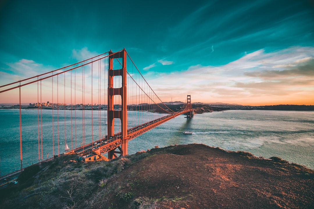
Unraveling the Maritime Mystery of Santa Monica Basin
The Santa Monica Basin, a significant geological depression off the coast of Southern California, presents a complex and enduring maritime mystery. Its depths, ranging from relatively shallow continental shelf areas to abyssal plains, have long held secrets. These secrets are not just geological marvels, but also fragments of human history, lost vessels, and submerged geological formations that continue to intrigue and challenge researchers. The basin’s geological evolution is intertwined with its history as a thoroughfare, a dumping ground, and a canvas for natural phenomena, each layer adding a new dimension to its enigmatic character. Investigating these depths requires a multidisciplinary approach, blending oceanography, archaeology, geology, and even marine biology, to piece together a comprehensive understanding of this fascinating oceanic region. The challenges are substantial, from the immense pressure of the deep sea to the logistical complexities of scientific exploration in a busy maritime environment. Yet, the potential rewards – unraveling the basin’s past and understanding its present – make the pursuit worthwhile.
The Santa Monica Basin’s very existence is a testament to intricate geological processes. Its formation is deeply rooted in the tectonic activity that characterizes the Southern California margin, a region marked by significant fault lines and the dynamic interaction of tectonic plates. Understanding these fundamental geological underpinnings is crucial to appreciating the basin’s subsequent history and the mysteries it holds.
Tectonic Origins and Plate Tectonics
The Santa Monica Basin is situated in a tectonically active zone. The San Andreas Fault system, a transform fault, dominates the regional geology. However, the basin’s formation is more directly influenced by a complex network of smaller faults, including the Malibu Coast Fault zone and the Santa Monica Fault, which exhibit both strike-slip and dip-slip components. These faults scar the seafloor and are responsible for the basin’s subsidence and the creation of its significant depth gradient. The North American Plate and the Pacific Plate grind past each other, but in this region, the interaction is more complex, involving regional compression and extension which contribute to the formation of basins like the Santa Monica.
Understanding Fault Activity and Seismicity
The presence of active faults within and around the Santa Monica Basin means that seismic activity is a constant consideration. Earthquakes, both large and small, have shaped the basin’s bathymetry and continue to influence its geological evolution. Seismological studies provide invaluable data on the frequency, magnitude, and focal mechanisms of earthquakes, offering insights into the stresses and strains acting upon the Earth’s crust in this area. Understanding the recurrence intervals of major seismic events is critical for hazard assessment and for interpreting the geological record of past deformations that may have impacted the basin.
Subsidence and Sedimentation Patterns
Over geological timescales, subsidence has played a key role in creating and deepening the Santa Monica Basin. This downward movement of the Earth’s crust has allowed for the accumulation of vast quantities of sediment transported from the adjacent landmass. Rivers, particularly the Los Angeles River and its historical predecessors, have been major conduits for sediment delivery. Understanding the rate and patterns of subsidence, coupled with sediment deposition, helps in dating geological strata and understanding the historical environmental conditions of the region. This sedimentation also buries historical phenomena, contributing to the mystery of what lies beneath.
Bathymetric Features and Underwater Topography
The seafloor of the Santa Monica Basin is far from uniform. It presents a diverse array of topographic features that have been meticulously mapped by sonar and other advanced surveying technologies. These features are direct indicators of the geological processes at play and the history of the basin.
The Shelf Break and Slope Transition
The transition from the relatively shallow continental shelf to the steeper continental slope is a prominent feature. This break marks a significant change in depth, and thus in environmental conditions. Understanding the morphology of this transition is important for marine ecological studies, as it often acts as a boundary between different faunal communities and influences sediment transport. The stability of the slope is also a factor, with potential for underwater landslides which can reshape the seafloor and pose hazards.
Abyssal Plains and Deep Channels
As one moves further offshore and into the deeper parts of the basin, vast abyssal plains emerge. These are relatively flat, sediment-covered areas typically found at depths of several thousand meters. Within these plains, or sometimes cutting across them, can be found deep-sea channels, often formed by the erosive power of turbidity currents – dense flows of sediment-laden water that can travel long distances across the ocean floor. These channels can act as highways for sediment transport and may also contain unique geological formations or biological communities adapted to these extreme environments.
The Santa Monica Basin has long been a subject of intrigue, with numerous maritime mysteries surrounding its depths. A related article that delves deeper into the enigmatic occurrences in this area can be found at XFile Findings. This piece explores various theories and documented incidents that have contributed to the basin’s reputation as a hotspot for unexplained phenomena, making it a fascinating read for those interested in maritime mysteries.
Echoes of the Past: Submerged Shipwrecks and Maritime Artifacts
The Santa Monica Basin, like many active maritime corridors, has been a silent repository for countless lost vessels and their associated artifacts. These submerged remnants offer tangible links to past human endeavors, the challenges of seafaring, and the economic activities that once plied these waters. Uncovering and studying these sites is a significant undertaking, often revealing more about lost history than was previously known.
Historical Shipping Routes and Trade
Historically, the waters off the coast of Southern California served as a vital artery for trade and travel. From early Spanish exploration to the bustling ports of the 20th century, ships have navigated these waters, transporting goods, people, and materials. The Santa Monica Basin was part of this network, and its submerged features may hold evidence of vessels that met their end due to storms, navigational errors, or unforeseen accidents.
Early Exploration and Spanish Galleons
While direct evidence of Spanish galleons within the Santa Monica Basin might be scarce compared to more southerly routes, the general period of exploration and early settlement implies potential losses. The challenges of navigating unfamiliar coastlines with rudimentary technology meant risks were ever-present. Any such discoveries would offer invaluable insights into maritime technology and trade practices of that era.
19th and 20th Century Commerce and Industry
As Los Angeles and its surrounding areas grew into major centers of commerce, maritime traffic intensified. Sailing ships, steamships, and eventually modern vessels plied the waters, carrying goods for industries ranging from agriculture to oil. Wrecks from this period, often more documented but still challenging to locate, can shed light on specific shipping companies, cargo types, and the economic development of the region. The transition from sail to steam also introduces different types of technological artifacts to the archaeological record.
Identifying and Cataloging Shipwreck Sites
The National Oceanic and Atmospheric Administration (NOAA) and various state and local agencies have undertaken efforts to map and catalog known and potential shipwreck sites within the Santa Monica Basin. This work often involves using remote sensing technologies and historical research to identify areas of interest.
Sonar and Sub-bottom Profiling Techniques
Multibeam sonar systems are essential for creating detailed bathymetric maps of the seafloor, revealing anomalies that could indicate the presence of shipwrecks. Sub-bottom profilers send sound waves into the sediment to penetrate the seafloor, potentially revealing buried wrecks or debris fields that are not visible on the surface. These technologies are crucial for initial surveys and for narrowing down areas for further investigation.
Underwater Photography and Videography
Once potential sites are identified, Remotely Operated Vehicles (ROVs) and Autonomous Underwater Vehicles (AUVs) equipped with high-definition cameras are deployed to visually inspect the wrecks. These tools allow researchers to document the condition of the vessel, identify artifacts, and assess the overall state of preservation. Detailed photographic and video records are vital for archaeological analysis and for creating a lasting record of the site.
Challenges in Archaeological Recovery and Preservation
The deep-sea environment of the Santa Monica Basin presents significant challenges to archaeological recovery and preservation. The immense pressure, low temperatures, and corrosive saltwater all impact the condition of submerged artifacts. Furthermore, the ethical considerations surrounding the disturbance of potential historical sites are paramount.
Environmental Factors Affecting Preservation
The rate of degradation for organic materials, such as wood and textiles, is significantly slowed in the cold, oxygen-poor deep-sea environment. However, metal artifacts are susceptible to corrosion. The shifting sediments on the seafloor can also bury or expose parts of a wreck, altering its context over time. Understanding these factors is crucial for interpreting findings and for planning any potential recovery operations.
Marine Growth and Biological Impact
Over time, shipwrecks become encrusted with marine organisms, forming artificial reefs. While this can help to stabilize some structures, it also obscures details and can make identification difficult without careful excavation or documentation. The biological communities that inhabit these wrecks are themselves of scientific interest, but their presence adds another layer of complexity to archaeological study.
Unseen Dumping Grounds: Past Industrial and Municipal Waste
Beyond historical shipwrecks, the Santa Monica Basin holds another, more troubling, layer of mystery: its past use as a disposal site for industrial and municipal waste. This practice, common in the mid-20th century before widespread environmental regulations, has left a legacy of potential contamination and has raised concerns about its long-term impact on the marine ecosystem.
Historical Waste Disposal Practices
In the absence of comprehensive waste management infrastructure, the ocean was often seen as a convenient and inexpensive solution for disposing of various types of waste. This included byproducts from manufacturing, sewage sludge, and other materials deemed undesirable on land. The Santa Monica Basin, due to its proximity to urban centers like Los Angeles, became a target for these disposal activities.
Industrial Byproducts and Chemical Contamination
Various industries, including chemical manufacturers and refineries, generated waste streams that were often discharged into the ocean. These byproducts could contain heavy metals, persistent organic pollutants, and other harmful substances. The long-term fate and distribution of these chemicals within the basin’s sediments and marine life are a subject of ongoing investigation.
Municipal Sewage Sludge Disposal
For several decades, significant quantities of sewage sludge, the solid material left over from wastewater treatment, were dumped in designated areas of the Santa Monica Basin. This practice introduced organic matter and a range of potential contaminants, including pathogens, heavy metals, and nutrients, into the marine environment.
Investigating the Presence and Impact of Contaminants
Numerous studies have been conducted to assess the extent of contamination within the Santa Monica Basin and its potential impact on marine life and human health. This research involves analyzing sediment samples, water quality, and the tissues of marine organisms.
Sediment Core Analysis and Contaminant Mapping
Analyzing sediment cores allows scientists to reconstruct the history of disposal activities and to identify the presence and concentration of various contaminants. By taking cores from different locations and depths, researchers can map the spatial distribution of pollutants and gain insights into their historical transport and accumulation within the basin. This provides a geological record of the human-induced changes.
Bioaccumulation and Trophic Transfer of Pollutants
Marine organisms can absorb contaminants from their environment or through their diet. This process, known as bioaccumulation, can lead to increasing concentrations of pollutants in organisms higher up the food chain, a phenomenon called trophic transfer. Studies have investigated the levels of contaminants, such as DDT and PCBs, and heavy metals in fish and marine mammals inhabiting the basin, assessing the potential risks to both wildlife and humans who consume seafood from these waters.
Remediation Efforts and Ongoing Monitoring
While many of the historical dumping practices have ceased, the legacy of contamination remains. Efforts have been made to monitor the environment and, in some cases, to undertake remediation measures to mitigate the impact of pollutants.
Post-Disposal Environmental Monitoring Programs
Following the cessation of major dumping activities, extensive monitoring programs have been implemented to track changes in water quality, sediment chemistry, and the health of marine populations. These programs provide crucial data on the long-term recovery of the ecosystem and help to identify any emerging issues.
Challenges of Seabed Remediation
Remediating contaminated seabeds in deep-water environments like the Santa Monica Basin is a complex and expensive undertaking. Options such as dredging or capping contaminated sediments have significant logistical and environmental challenges. The vastness of the affected areas and the depth of the water make complete cleanup often impractical, necessitating a focus on containment and long-term management.
Submerged Geological Features and Natural Phenomena
Beyond human history and industrial legacies, the Santa Monica Basin is a dynamic geological environment shaped by natural forces. Investigating these formations and phenomena provides insight into the Earth’s processes and the evolution of the seascape.
Submarine Canyons and Sediment Transport
The basin’s topography includes features that are actively involved in the transport of sediment and nutrients. Submarine canyons, V-shaped valleys carved into the continental slope, play a crucial role in this process.
Formation and Evolution of Submarine Canyons
These canyons are often initiated by erosion at the edge of the continental shelf and are deepened by powerful underwater currents, particularly turbidity currents. The continuous erosion and sediment transport through these canyons can shape the surrounding seafloor and influence the distribution of marine life. Studying their morphology and activity helps understand the forces that sculpt the ocean floor.
Role in Nutrient Distribution and Biological Productivity
Submarine canyons can act as conduits, transporting nutrients from the shelf to deeper waters. This nutrient flux can stimulate primary productivity in the overlying water column, supporting unique and often localized areas of high biological activity, including aggregations of fish and marine mammals.
Seamounts and Underwater Volcanoes
While not as volcanically active as some other oceanic regions, the proximity to the East Pacific Rise and the complex tectonic setting of Southern California means that the possibility of submerged volcanic features exists, although large well-documented seamounts directly within the basin are less common than some other offshore regions. However, the broader geological context suggests that smaller volcanic features or evidence of past volcanic activity could be present.
Evidence of Past Volcanic Activity
The geological history of the Pacific coast of North America includes periods of volcanic activity. While the immediate basin may not be a primary volcanic center, related activity or the presence of older, eroded volcanic structures cannot be entirely ruled out and contributes to the overall geological mystery of the region.
Methane Seeps and Cold Seeps
The geological activity and the presence of organic matter within the sediments of the Santa Monica Basin can lead to the formation of methane seeps. These are areas where methane gas, primarily produced by the decomposition of organic material by microbes in the seabed, escapes into the water column.
Microbial Communities and Unique Ecosystems
Methane seeps are often associated with unique chemosynthetic ecosystems. Instead of relying on sunlight for energy, the primary producers in these environments utilize chemical energy, such as the oxidation of methane and hydrogen sulfide. These specialized communities include bacteria, archaea, and various invertebrates that have adapted to these extreme conditions, forming distinct biological oases.
Geochemical Cycles and Carbon Sequestration
Methane seeps play a role in global geochemical cycles. While methane is a potent greenhouse gas when released into the atmosphere, a significant portion of it can be consumed by microbes in the seabed and water column, effectively sequestering carbon. Understanding the flux of methane from seeps in the Santa Monica Basin provides data for global carbon cycle models.
The Santa Monica Basin has long been a subject of intrigue, with its depths holding secrets that have puzzled researchers and enthusiasts alike. A fascinating article explores various maritime mysteries, including the enigmatic features of this underwater landscape. For those interested in delving deeper into these mysteries, you can read more about it in this insightful piece on XFile Findings, which sheds light on the historical and scientific aspects of the region.
The Future of Exploration and Ongoing Research
| Location | Maritime Mystery Santa Monica Basin |
|---|---|
| Depth | Approximately 3,000 meters |
| Area | Around 2,000 square kilometers |
| Phenomenon | Unexplained disappearances of ships and aircraft |
| Occurrences | Reported since the 1940s |
| Investigations | Ongoing research and exploration |
The mysteries of the Santa Monica Basin are far from fully unraveled. Ongoing research and advancements in technology continue to shed light on its complex history and its dynamic present. The pursuit of knowledge in this maritime realm is a continuous endeavor, driven by scientific curiosity and the need to understand our planet’s oceans.
Technological Advancements in Underwater Exploration
Technological progress is continuously pushing the boundaries of what is possible in ocean exploration. Sophisticated sonar, autonomous underwater vehicles, and advanced sampling techniques are enabling researchers to map, observe, and collect data from previously inaccessible areas with greater precision and efficiency.
Next-Generation AUVs and ROVs
Modern AUVs and ROVs are equipped with increasingly sophisticated sensors, including high-resolution cameras, environmental sensors, and manipulator arms, allowing for more detailed investigations and even the potential for sample collection in challenging environments. Their ability to operate for extended periods and at significant depths makes them invaluable tools.
Unmanned Surface Vessels (USVs) and Remote Sensing
The integration of Unmanned Surface Vessels (USVs) with AUVs and ROVs is streamlining data acquisition and survey operations. USVs can act as communication hubs and deploy/recover underwater assets, while also carrying their own sensor suites for broad-area mapping and environmental monitoring.
Interdisciplinary Research Collaboration
Addressing the multifaceted mysteries of the Santa Monica Basin requires collaboration among researchers from various disciplines. Oceanographers, geologists, archaeologists, biologists, and chemists must work together to synthesize their findings and develop a holistic understanding of the basin’s complex ecosystem and history.
Integrating Geological, Archaeological, and Biological Data
Combining data from geological surveys of seafloor formations, archaeological investigations of submerged sites, and biological surveys of marine communities provides a more complete picture. For example, understanding sediment transport patterns can inform where shipwrecks might be preserved or how contaminants are dispersed, while also influencing habitat distribution for marine life.
Establishing Baseline Data and Long-Term Monitoring
Establishing robust baseline data for the basin’s environmental conditions is crucial for tracking future changes, particularly in the context of climate change and potential impacts from human activities. Long-term monitoring programs are essential for detecting subtle shifts in ocean chemistry, biodiversity, and geological stability.
Public Engagement and Education
Sharing the findings of research conducted in the Santa Monica Basin with the public is vital for fostering environmental awareness and support for ocean conservation. Educational initiatives can highlight the importance of the marine environment, the challenges of ocean research, and the wonders that lie beneath the waves.
Citizen Science and Data Collection Initiatives
Opportunities for citizen science, where the public can participate in data collection or reporting, can amplify research efforts and promote a sense of stewardship. While direct participation in deep-sea exploration is limited, citizen science can be valuable for coastal monitoring and reporting of marine phenomena.
Museums, Documentaries, and Online Resources
Presenting research through accessible mediums such as museum exhibits, documentaries, and interactive online platforms can engage a broad audience and communicate the significance of the Santa Monica Basin’s mysteries and the ongoing efforts to understand them. These channels are crucial for translating complex scientific findings into understandable narratives for the general public.
The Santa Monica Basin, therefore, remains a region of profound intrigue. Its depths hold stories etched in geology and human endeavor, stories that scientists are diligently working to unearth, one discovery at a time. The ongoing exploration promises to continue unraveling its layers, revealing further insights into the natural world and our own past.
FAQs
What is the Santa Monica Basin?
The Santa Monica Basin is a deep-water basin located off the coast of Southern California, near the city of Santa Monica. It is known for its unique oceanographic features and diverse marine life.
What is the maritime mystery in the Santa Monica Basin?
The maritime mystery in the Santa Monica Basin refers to the discovery of several shipwrecks and other submerged artifacts that have puzzled researchers and historians. These underwater findings have raised questions about the history and significance of maritime activity in the area.
What are some of the theories about the shipwrecks in the Santa Monica Basin?
Some theories about the shipwrecks in the Santa Monica Basin suggest that they could be remnants of historic naval battles, merchant vessels, or even pirate ships. Researchers are also exploring the possibility that some of the shipwrecks may be linked to smuggling or illegal activities.
What efforts are being made to uncover the maritime mystery in the Santa Monica Basin?
Researchers and marine archaeologists are conducting underwater surveys, using advanced technology such as sonar and remotely operated vehicles, to explore and document the shipwrecks and other submerged artifacts in the Santa Monica Basin. These efforts aim to shed light on the historical significance of the maritime mystery.
What is the significance of unraveling the maritime mystery in the Santa Monica Basin?
Unraveling the maritime mystery in the Santa Monica Basin can provide valuable insights into the region’s maritime history, trade routes, and cultural connections. It can also contribute to the preservation and protection of underwater cultural heritage and promote public awareness of the area’s rich maritime heritage.