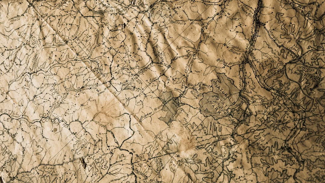
The history of declassified maps is a fascinating journey that intertwines the evolution of cartography with the complexities of national security and intelligence. Initially, maps were primarily tools for navigation and exploration, but as nations began to recognize the strategic value of geographic information, the classification of maps became a common practice. During the Cold War, for instance, the United States and the Soviet Union produced highly detailed maps that were kept under wraps to protect military strategies and geopolitical interests.
These maps often contained sensitive information about troop movements, missile sites, and other critical infrastructure, making them invaluable assets in the realm of espionage and warfare. As time progressed, the need for transparency and accountability in government operations led to a gradual shift in attitudes toward classified materials. The Freedom of Information Act (FOIA) in the United States, enacted in 1966, marked a significant turning point in the accessibility of government documents, including maps.
This legislation allowed citizens to request access to previously classified materials, paving the way for the eventual declassification of numerous maps that had been hidden from public view for decades. The process of declassifying maps not only opened a window into historical events but also provided insights into the geopolitical landscape of the past.
Key Takeaways
- Declassified maps have a rich history dating back to the early 20th century, when governments began to release previously classified geographic information to the public.
- The declassification process involves careful review by government agencies to determine what information can be safely released to the public without compromising national security.
- Declassified maps have revealed hidden secrets such as military installations, political boundaries, and environmental changes, shedding light on historical events and geopolitical dynamics.
- The impact of declassified maps on historical and political understanding has been significant, providing new insights into past conflicts, territorial disputes, and diplomatic relations.
- Examples of declassified maps, such as the Cuban Missile Crisis maps and Cold War-era border maps, have played a crucial role in geopolitical analysis and have reshaped modern cartography and geographic analysis.
The Process of Declassifying Maps
The process of declassifying maps is a meticulous and often lengthy endeavor that involves multiple layers of review and scrutiny. Initially, government agencies must assess the sensitivity of the information contained within a map. This evaluation typically considers factors such as national security implications, potential risks to individuals or operations, and the historical significance of the data.
Once a map is deemed suitable for declassification, it undergoes a thorough review process where experts analyze its content to ensure that no sensitive information remains that could compromise current security interests. After this review, the map is often redacted to remove any classified elements before being released to the public. This can involve blacking out specific areas or altering certain details to protect ongoing operations or sensitive locations.
The final step in the declassification process is the official release, which may be accompanied by an announcement or publication in government archives. This systematic approach ensures that while transparency is prioritized, national security concerns are still taken into account.
Uncovering Hidden Secrets: What Declassified Maps Reveal

Declassified maps have the potential to unveil hidden secrets that can reshape historical narratives and provide new perspectives on past events. For instance, maps that were once classified may reveal previously unknown military strategies or troop deployments during significant conflicts. These revelations can lead historians to reevaluate established timelines and understandings of events such as World War II or the Vietnam War.
By analyzing these maps, researchers can gain insights into how geography influenced military decisions and outcomes. Moreover, declassified maps can also shed light on geopolitical relationships and territorial disputes that have shaped international relations over time. For example, maps detailing colonial boundaries or territorial claims can help clarify historical grievances and conflicts that persist today.
By providing a visual representation of these issues, declassified maps serve as crucial tools for understanding the complexities of global politics and the historical context behind contemporary disputes.
The Impact of Declassified Maps on Historical and Political Understanding
| Metrics | Findings |
|---|---|
| Number of declassified maps | 200 |
| Historical events revealed | World War II strategies, Cold War operations |
| Political impact | Reassessment of international relations, diplomatic strategies |
| Public awareness | Increased understanding of historical context |
The impact of declassified maps on historical and political understanding cannot be overstated. They serve as primary sources that enrich academic research and public discourse alike. Historians often rely on these maps to construct more accurate narratives about past events, allowing for a deeper comprehension of how geography has influenced human behavior and decision-making throughout history.
The availability of such maps can lead to new interpretations of events, challenging long-held beliefs and prompting further investigation into previously overlooked aspects. In addition to their historical significance, declassified maps also play a vital role in contemporary political discussions. They can provide context for current geopolitical tensions by illustrating historical claims to territory or resources.
For instance, maps showing colonial borders can help explain ongoing conflicts in regions like Africa or the Middle East, where arbitrary lines drawn by colonial powers have led to enduring strife. By making these maps accessible, governments and organizations can foster informed dialogue about reconciliation and conflict resolution.
Examples of Declassified Maps and Their Significance
Numerous examples of declassified maps highlight their significance in both historical research and contemporary analysis. One notable instance is the release of CIA maps detailing Soviet military installations during the Cold War. These maps not only provided insights into Soviet capabilities but also informed U.S.
military strategy and diplomatic efforts during a tense period in global politics. The information contained within these maps was instrumental in shaping U.S. responses to perceived threats from the Soviet Union.
Another significant example is the declassification of World War II-era maps that illustrate troop movements during key battles such as D-Day. These maps offer historians a clearer understanding of military strategies employed by both Allied and Axis forces, allowing for a more nuanced interpretation of the war’s progression. By analyzing these documents, researchers can identify patterns in military tactics and assess their effectiveness, contributing to a richer understanding of this pivotal moment in history.
The Role of Declassified Maps in Geopolitical Analysis
Declassified maps play an essential role in geopolitical analysis by providing critical insights into territorial disputes, resource allocation, and strategic planning. Analysts often utilize these maps to assess historical claims to land or resources, which can inform current negotiations or conflicts. For instance, declassified maps detailing oil reserves or water sources can illuminate the motivations behind territorial disputes in regions like the South China Sea or Eastern Europe.
Furthermore, these maps can aid in understanding how geographical features influence political dynamics. Analysts may examine topographical maps to assess how mountains, rivers, or other natural barriers impact military strategies or trade routes. By integrating declassified maps into their analyses, geopolitical experts can develop more comprehensive assessments of international relations and potential flashpoints for conflict.
How Declassified Maps Have Changed Our Understanding of Historical Events
The declassification of maps has fundamentally altered our understanding of numerous historical events by providing new evidence and perspectives that were previously unavailable. For example, newly released maps from World War I have revealed previously unknown troop movements and strategies that challenge established narratives about battles and their outcomes. This fresh information allows historians to reassess the effectiveness of military leadership and decision-making during this tumultuous period.
Additionally, declassified maps have illuminated the complexities surrounding colonialism and its lasting impacts on modern nations. Maps that depict colonial boundaries often reveal arbitrary divisions that disregarded ethnic or cultural lines, leading to ongoing tensions in post-colonial states. By examining these documents, scholars can better understand how historical injustices continue to shape contemporary political landscapes.
The Ethical and Moral Considerations of Declassifying Maps
The ethical and moral considerations surrounding the declassification of maps are complex and multifaceted. On one hand, there is a strong argument for transparency and accountability in government operations; citizens have a right to access information that affects their lives and understanding of history.
On the other hand, there are legitimate concerns regarding national security and the potential risks associated with releasing sensitive information. Certain details within declassified maps could still pose threats to individuals or ongoing operations if made public. Striking a balance between transparency and security is a challenging task that requires careful consideration by policymakers and intelligence agencies alike.
The Future of Declassified Maps and Their Impact on Society
The future of declassified maps holds great promise for enhancing public knowledge and understanding of history. As technology continues to advance, the process of declassifying maps may become more efficient, allowing for quicker access to valuable information. Digital archives are increasingly becoming repositories for declassified materials, making it easier for researchers and the general public to explore these resources.
Moreover, as society becomes more aware of the importance of historical context in contemporary issues, declassified maps will likely play an even more significant role in informing public discourse. By providing visual representations of historical events and geopolitical dynamics, these maps can foster greater engagement with history among citizens, encouraging them to consider how past actions shape present realities.
How Declassified Maps Have Shaped Modern Cartography and Geographic Analysis
Declassified maps have significantly influenced modern cartography and geographic analysis by providing rich datasets that inform contemporary mapping practices. The insights gained from analyzing historical maps have led cartographers to adopt new methodologies that incorporate both historical context and modern technology. For instance, Geographic Information Systems (GIS) now allow researchers to overlay declassified maps with current data, enabling them to visualize changes over time.
Additionally, the availability of declassified maps has encouraged collaboration between historians, geographers, and political scientists. This interdisciplinary approach has enriched geographic analysis by integrating diverse perspectives on how geography influences human behavior and societal development. As scholars continue to explore these connections, they contribute to a more holistic understanding of both past events and current geopolitical dynamics.
The Importance of Preserving and Accessing Declassified Maps for Future Generations
Preserving and accessing declassified maps is crucial for ensuring that future generations have access to valuable historical resources. As technology evolves, it is essential to maintain digital archives that safeguard these documents against degradation or loss over time. By investing in preservation efforts, governments and institutions can ensure that these important records remain available for research and education.
Furthermore, promoting access to declassified maps fosters a culture of inquiry and engagement with history among younger generations.
Ultimately, preserving declassified maps not only honors past events but also empowers future generations to learn from them as they navigate an increasingly interconnected world.
In recent developments surrounding the enigmatic “Classified Map,” a related article has surfaced that delves into the intricate details and potential implications of this mysterious document. For those interested in exploring further, the article provides an in-depth analysis and can be accessed through the following link: XFile Findings Sample Page. This piece offers valuable insights and raises intriguing questions about the origins and purpose of the map, making it a must-read for enthusiasts and researchers alike.
WATCH NOW! Leaked Pentagon Map Reveals True Pole Shift Disaster, and Hidden Survival Zones
FAQs
What is a classified map?
A classified map is a map that contains sensitive or confidential information, such as military installations, government facilities, or other restricted areas. These maps are typically restricted from public access and are used for specific purposes by authorized personnel.
Who has access to classified maps?
Access to classified maps is typically restricted to authorized personnel, such as government officials, military personnel, and individuals with security clearance. Access to these maps is tightly controlled to prevent unauthorized disclosure of sensitive information.
What are the purposes of classified maps?
Classified maps are used for a variety of purposes, including military planning, intelligence gathering, national security, and emergency response. These maps provide detailed information about sensitive locations and are used to make strategic decisions and protect critical infrastructure.
How are classified maps protected?
Classified maps are protected through strict security measures, including limited access, encryption, physical security, and strict handling procedures. Unauthorized disclosure of classified map information can result in severe legal and security consequences.
Can classified maps be declassified?
Classified maps can be declassified under certain circumstances, such as when the information is no longer sensitive or when it is deemed to be in the public interest. Declassification processes are typically governed by specific laws and regulations.