
Antarctica, often regarded as the last great wilderness on Earth, is not just a land of ice and snow; it is also a hub of advanced technological research. Beneath its frozen surface lies a wealth of scientific knowledge waiting to be uncovered. The continent’s extreme conditions have spurred the development of innovative technologies that are crucial for understanding its vast ice sheets and their implications for global sea levels.
As scientists strive to unravel the mysteries of this remote region, they rely on cutting-edge tools and techniques that push the boundaries of exploration and research. The significance of Antarctica extends beyond its breathtaking landscapes; it plays a pivotal role in the Earth’s climate system. The ice sheets that blanket the continent hold vast amounts of freshwater, and their stability is vital for maintaining global sea levels.
As climate change accelerates, understanding the dynamics of these ice sheets becomes increasingly urgent. The secret technologies employed in Antarctica not only enhance scientific inquiry but also provide critical insights into the future of our planet. This article delves into the various technological advancements that are transforming the study of Antarctica’s ice sheets, revealing how they contribute to our understanding of climate change and its far-reaching effects.
Key Takeaways
- Advanced technologies are crucial for studying and understanding Antarctica’s ice sheets.
- Remote sensing, UAVs, and autonomous vehicles enable detailed exploration of ice-covered regions.
- Ice-penetrating radar and sonar provide insights into ice thickness and subglacial features.
- Innovative ice core drilling and climate modeling tools help reconstruct past climates and predict future changes.
- Ongoing technological advancements face challenges but hold promise for improved ice sheet monitoring and climate research.
The Role of Technology in Studying Antarctica’s Ice Sheets
Technology serves as a cornerstone in the quest to comprehend Antarctica’s ice sheets, which are among the largest reservoirs of freshwater on Earth. The sheer scale and complexity of these ice formations present unique challenges for researchers. Traditional methods of data collection, such as manual surveys and ground-based observations, are often insufficient to capture the dynamic processes occurring within and beneath the ice.
Consequently, scientists have turned to advanced technologies that enable them to gather comprehensive data over vast areas with greater precision. One of the primary roles of technology in this context is to facilitate real-time monitoring of ice sheet changes. By employing satellite imagery and remote sensing techniques, researchers can track shifts in ice mass, flow rates, and surface temperatures.
Furthermore, the integration of data from various sources enhances the accuracy of models that predict future changes in ice sheet behavior, ultimately informing global climate projections.
Cutting-Edge Tools for Ice Sheet Research
The arsenal of tools available for ice sheet research has expanded dramatically in recent years, thanks to advancements in engineering and technology. Among these tools are sophisticated satellite systems equipped with radar and laser altimetry capabilities. These satellites can measure changes in ice thickness and surface elevation with remarkable accuracy, enabling scientists to assess the health of ice sheets over time.
The data collected from these satellites is invaluable for understanding how ice sheets respond to environmental changes. In addition to satellite technology, ground-based instruments have also evolved significantly. Researchers now utilize automated weather stations that provide continuous data on temperature, wind speed, and precipitation levels in remote areas of Antarctica.
These stations are essential for understanding local climatic conditions and their influence on ice sheet dynamics. Moreover, portable field instruments allow scientists to conduct on-site measurements of ice properties, such as density and temperature gradients, further enriching their understanding of these complex systems.
Remote Sensing and Imaging Techniques in Antarctica
| Technique | Sensor Type | Application | Spatial Resolution | Temporal Resolution | Example Data Source |
|---|---|---|---|---|---|
| Optical Remote Sensing | Multispectral / Hyperspectral | Surface mapping, ice extent, vegetation monitoring | 10-30 meters | Days to weeks | Landsat, Sentinel-2 |
| Synthetic Aperture Radar (SAR) | Microwave Radar | Ice sheet dynamics, glacier movement, snow accumulation | 1-100 meters | Days to weeks | Sentinel-1, RADARSAT |
| Lidar | Laser Altimetry | Surface elevation, ice thickness, topography | 1-10 meters | Variable (campaign-based) | ICESat-2, Operation IceBridge |
| Thermal Infrared Imaging | Thermal Sensors | Surface temperature, meltwater detection | 100 meters to 1 km | Days to weeks | MODIS, ASTER |
| Gravimetry | Satellite Gravity Sensors | Mass balance, ice sheet mass changes | ~100 km | Monthly to yearly | GRACE, GRACE-FO |
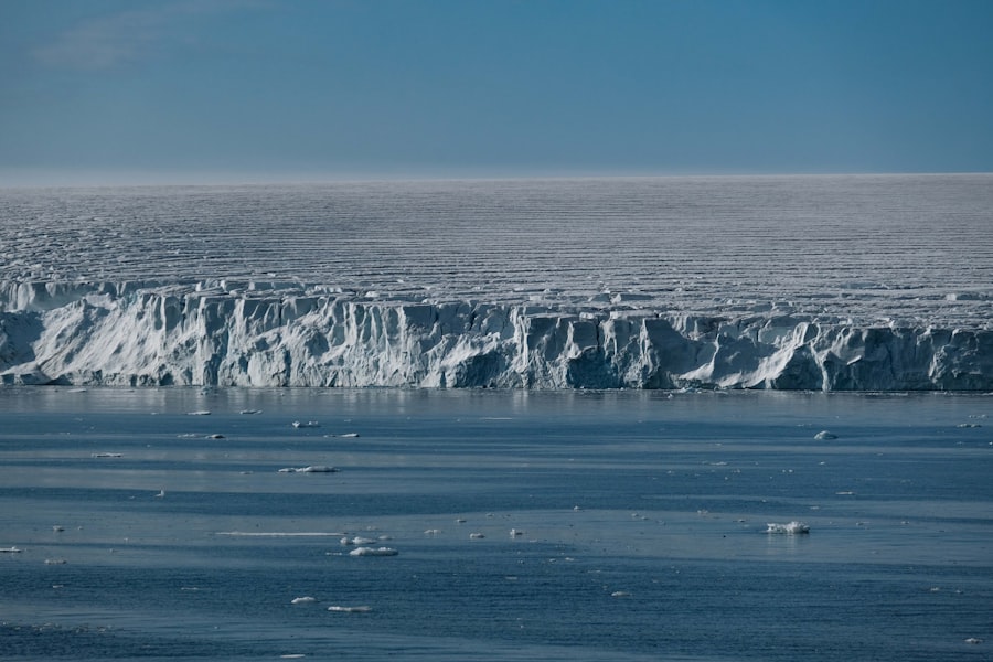
Remote sensing has revolutionized the way scientists study Antarctica’s ice sheets by providing a bird’s-eye view of this vast and inhospitable landscape. Utilizing satellite imagery, researchers can analyze large-scale changes in ice cover and identify areas at risk of melting or destabilization. This technique allows for the monitoring of seasonal variations and long-term trends, offering critical insights into how climate change is affecting the continent.
Imaging techniques such as synthetic aperture radar (SAR) have proven particularly effective in capturing detailed information about ice flow patterns and surface deformation. By analyzing radar signals reflected off the ice surface, scientists can create high-resolution maps that reveal intricate features such as crevasses and rifts. These maps are essential for understanding how stress is distributed across the ice sheet and predicting potential collapse scenarios.
The ability to visualize these changes in real-time enhances researchers’ capacity to respond to emerging threats posed by climate change.
Unmanned Aerial Vehicles (UAVs) for Ice Sheet Exploration
Unmanned Aerial Vehicles (UAVs), commonly known as drones, have emerged as powerful tools for exploring Antarctica’s ice sheets. These versatile machines can access remote areas that are often difficult or dangerous for human researchers to reach. Equipped with high-resolution cameras and sensors, UAVs can capture detailed images and collect data on ice thickness, surface conditions, and even biological activity in polar ecosystems.
The use of UAVs has transformed fieldwork in Antarctica by enabling researchers to conduct surveys more efficiently and safely. Drones can cover large areas in a fraction of the time it would take traditional methods, allowing scientists to gather data quickly and effectively. Additionally, UAVs can be deployed during harsh weather conditions when ground-based operations may be compromised, ensuring that research continues uninterrupted.
As technology advances, UAVs are expected to play an even more significant role in Antarctic research, providing unprecedented access to this remote environment.
Ice-Penetrating Radar and Sonar Technology

Ice-penetrating radar (IPR) is one of the most critical technologies used in studying Antarctica’s ice sheets. This technique allows scientists to investigate the internal structure of ice layers without having to drill through them physically. By emitting radar waves that penetrate the ice, researchers can gather information about ice thickness, subglacial topography, and even the presence of water beneath the ice sheet.
Sonar technology complements IPR by providing insights into underwater features that are otherwise hidden from view. When deployed beneath the ice shelf or in subglacial lakes, sonar systems can map the seafloor and identify geological formations that influence ice dynamics. This information is crucial for understanding how ocean currents interact with ice shelves and contribute to their melting.
Together, IPR and sonar technology offer a comprehensive view of both the surface and subsurface processes affecting Antarctica’s ice sheets.
Autonomous Underwater Vehicles (AUVs) for Under-Ice Exploration
Autonomous Underwater Vehicles (AUVs) represent a significant advancement in under-ice exploration technology. These unmanned submersibles are designed to operate autonomously beneath the ice shelf, collecting data on water temperature, salinity, and currents without direct human intervention. AUVs can navigate complex underwater environments, providing valuable insights into how oceanic conditions influence ice sheet stability.
The deployment of AUVs has opened new avenues for research in subglacial environments that were previously inaccessible. By mapping underwater features and monitoring changes over time, scientists can better understand the interactions between ocean water and glacial ice. This knowledge is essential for predicting how warming oceans may accelerate ice melt and contribute to rising sea levels.
As AUV technology continues to evolve, it holds great promise for enhancing our understanding of Antarctica’s hidden ecosystems.
Advanced Ice Core Drilling Technology
Ice core drilling remains one of the most effective methods for studying past climate conditions preserved within Antarctica’s ice sheets.
Modern drills are equipped with sophisticated sensors that allow researchers to extract continuous cores while minimizing contamination from surrounding materials.
The analysis of ice cores provides invaluable information about historical climate patterns, greenhouse gas concentrations, and volcanic activity over millennia. By examining layers within the cores, scientists can reconstruct past temperatures and atmospheric conditions, offering insights into natural climate variability and human-induced changes. The advancements in drilling technology not only enhance data quality but also enable researchers to reach deeper layers of ice that hold critical information about Earth’s climatic history.
Climate Modeling and Simulation Tools for Antarctica
Climate modeling plays a crucial role in predicting future changes in Antarctica’s ice sheets and their potential impact on global sea levels. Advanced simulation tools allow researchers to create detailed models that incorporate various factors influencing ice dynamics, including temperature fluctuations, ocean currents, and atmospheric conditions. These models help scientists understand how different scenarios may unfold under varying climate change trajectories.
The integration of observational data from remote sensing technologies enhances the accuracy of climate models by providing real-time feedback on current conditions. By comparing model predictions with actual observations, researchers can refine their simulations and improve their understanding of complex interactions within the climate system. As computational power continues to grow, so too does the potential for more sophisticated models that can capture the intricacies of Antarctic climate dynamics.
Innovations in Ice Sheet Monitoring and Data Collection
The landscape of ice sheet monitoring has been transformed by recent innovations in data collection techniques. Researchers now employ a combination of satellite observations, ground-based measurements, and aerial surveys to create comprehensive datasets that inform their understanding of ice sheet behavior. This multi-faceted approach allows for cross-validation of findings and enhances confidence in research conclusions.
Innovative data collection methods also include citizen science initiatives that engage the public in monitoring efforts. By utilizing smartphone applications or online platforms, individuals can contribute observations related to snow cover or glacial retreat from their own locations. This democratization of data collection not only broadens participation but also enriches scientific knowledge by incorporating diverse perspectives from around the world.
Future Prospects and Challenges in Antarctica’s Ice Sheet Technology
As technology continues to advance at an unprecedented pace, the future prospects for studying Antarctica’s ice sheets appear promising yet fraught with challenges. The ongoing development of new tools and techniques will undoubtedly enhance researchers’ ability to monitor changes in real-time and improve predictive models for future scenarios. However, these advancements must be accompanied by a commitment to sustainable practices that minimize environmental impact in this fragile ecosystem.
One significant challenge lies in securing funding for continued research efforts in Antarctica amidst competing global priorities. As climate change intensifies, it becomes increasingly vital to prioritize investments in scientific exploration that can inform policy decisions aimed at mitigating its effects. Collaborative international efforts will be essential for addressing these challenges effectively while ensuring that technological advancements contribute positively to our understanding of this critical region.
In conclusion, Antarctica’s secret tech represents a remarkable intersection of science and innovation that is reshaping our understanding of one of Earth’s most enigmatic environments. Through cutting-edge tools such as UAVs, AUVs, remote sensing technologies, and advanced modeling techniques, researchers are uncovering vital information about the dynamics of ice sheets and their implications for global climate change. As we look toward the future, it is imperative that these technological advancements continue to be harnessed responsibly to protect this unique ecosystem while enhancing our knowledge of its role within the broader climate system.
Recent research has unveiled intriguing insights into the Antarctic ice sheet, revealing the potential for advanced technologies that could unlock its secrets. For a deeper understanding of the implications of these findings, you can explore a related article that discusses the intersection of climate science and innovative technology at