
Geophysical hazard data analysis plays a crucial role in understanding and mitigating the risks associated with natural disasters. This field encompasses a wide range of phenomena, including earthquakes, volcanic eruptions, tsunamis, landslides, floods, and geomagnetic disturbances. By systematically collecting and analyzing data related to these hazards, researchers can identify patterns, assess vulnerabilities, and develop strategies to minimize the impact of such events on human life and infrastructure.
The importance of this analysis is underscored by the increasing frequency and intensity of geophysical hazards, which are often exacerbated by factors such as climate change and urbanization. The integration of advanced technologies, such as remote sensing, geographic information systems (GIS), and machine learning, has significantly enhanced the capabilities of geophysical hazard data analysis. These tools allow for more precise modeling and forecasting of potential hazards, enabling communities to prepare more effectively.
As the world becomes more interconnected, the implications of geophysical hazards extend beyond local boundaries, necessitating a comprehensive approach to data analysis that considers regional and global contexts. This article will explore various research findings related to seismic, volcanic, tsunami, landslide, flood, earthquake, and geomagnetic hazards, as well as the influence of climate change and urbanization on these phenomena.
Key Takeaways
- Geophysical hazard data analysis is crucial for understanding and mitigating risks from natural disasters like earthquakes, volcanoes, tsunamis, landslides, floods, and geomagnetic events.
- Recent research highlights significant advancements in seismic, volcanic, tsunami, landslide, flood, earthquake, and geomagnetic hazard assessments, improving prediction accuracy.
- Climate change and urbanization are key factors influencing the frequency and impact of geophysical hazards, necessitating integrated data analysis approaches.
- Effective hazard management relies on combining multidisciplinary data insights to enhance early warning systems and disaster preparedness strategies.
- The article emphasizes the importance of continuous research and data integration to inform policy and reduce vulnerability to geophysical hazards globally.
Seismic Hazard Analysis Research Findings
Seismic hazard analysis has garnered significant attention in recent years due to the devastating impact of earthquakes on communities worldwide. Research findings indicate that understanding the geological and tectonic settings of regions prone to seismic activity is essential for effective hazard assessment. For instance, studies have shown that areas located near tectonic plate boundaries are at a higher risk of experiencing significant seismic events.
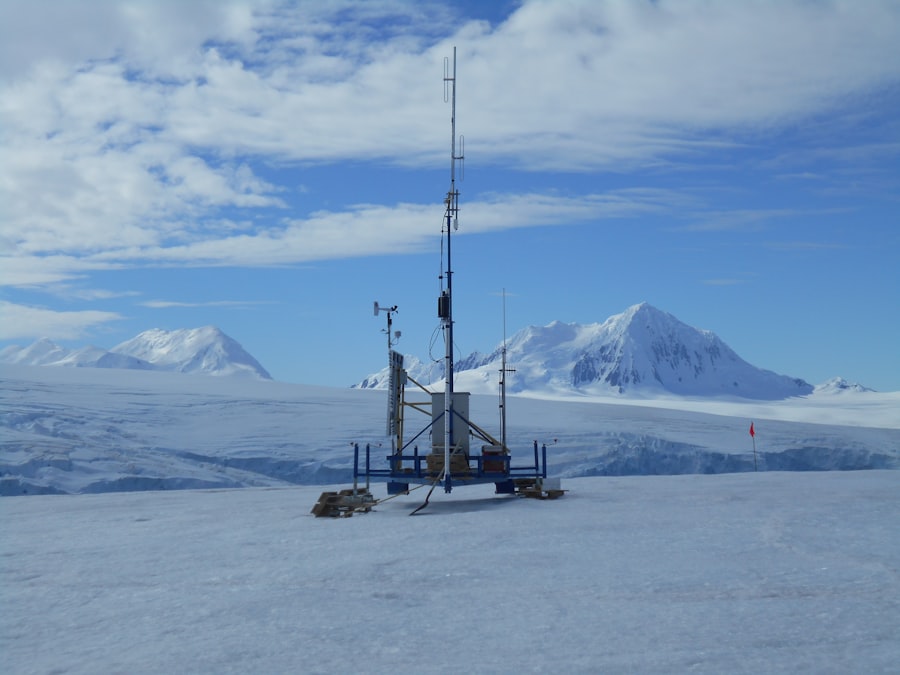
By analyzing historical earthquake data alongside geological surveys, researchers can create probabilistic seismic hazard maps that inform building codes and land-use planning. Moreover, advancements in technology have led to improved methods for real-time monitoring of seismic activity. The deployment of dense networks of seismometers allows for rapid detection and analysis of earthquakes as they occur.
This real-time data can be invaluable for issuing timely warnings to populations at risk, potentially saving lives and reducing economic losses. Recent research has also focused on the role of induced seismicity—earthquakes triggered by human activities such as fracking or reservoir-induced seismicity—highlighting the need for comprehensive regulations and monitoring systems to mitigate these risks.
Volcanic Hazard Analysis Research Findings

Volcanic hazard analysis is another critical area within geophysical hazard data analysis. The unpredictable nature of volcanic eruptions poses significant challenges for scientists and emergency management officials alike. Research has shown that monitoring volcanic gases, ground deformation, and seismic activity can provide valuable insights into potential eruptions.
For example, the use of satellite-based remote sensing technologies has revolutionized the ability to detect changes in volcanic activity from afar, allowing for early warning systems to be established in vulnerable regions. Furthermore, studies have highlighted the importance of understanding the historical behavior of volcanoes in assessing future risks. By analyzing past eruptions and their impacts on surrounding communities, researchers can develop more accurate models for predicting future events.
This knowledge is crucial for creating effective evacuation plans and risk communication strategies. Additionally, interdisciplinary approaches that incorporate social science perspectives are increasingly recognized as vital for understanding how communities perceive and respond to volcanic hazards.
Tsunami Hazard Analysis Research Findings
Tsunami hazard analysis is essential for coastal communities that face the threat of these powerful oceanic waves. Research findings emphasize the importance of early warning systems that rely on real-time data from seismic monitoring stations and ocean buoys. These systems can detect undersea earthquakes and monitor changes in sea level, providing critical information that can lead to timely evacuations.
Studies have shown that effective communication strategies are equally important; ensuring that communities understand the risks and know how to respond can significantly reduce casualties during a tsunami event. In addition to monitoring and communication efforts, researchers have focused on modeling tsunami propagation and inundation patterns. By utilizing advanced computational techniques, scientists can simulate how tsunamis will behave as they approach coastlines, taking into account factors such as bathymetry and coastal topography.
This information is vital for developing accurate hazard maps that inform land-use planning and emergency response strategies.
Landslide Hazard Analysis Research Findings
| Hazard Type | Data Source | Analysis Method | Key Metrics | Research Focus | Recent Findings |
|---|---|---|---|---|---|
| Earthquakes | Seismic Networks, GPS, Satellite Imagery | Seismic Waveform Analysis, Machine Learning, Statistical Modeling | Magnitude, Frequency, Epicenter Location, Ground Shaking Intensity | Prediction Models, Fault Zone Characterization | Improved early warning systems using AI-based pattern recognition |
| Volcanic Eruptions | Remote Sensing, Gas Emissions, Thermal Imaging | Time-Series Analysis, Geochemical Modeling, Thermal Anomaly Detection | Eruption Frequency, Gas Composition, Thermal Flux | Volcanic Activity Forecasting, Hazard Zonation | Correlation between gas emissions and eruption onset refined |
| Landslides | Topographic Maps, Rainfall Data, Satellite Radar | GIS Mapping, Slope Stability Modeling, Statistical Risk Assessment | Slope Angle, Soil Moisture, Rainfall Intensity, Displacement Rates | Early Warning Systems, Risk Mapping | Enhanced landslide susceptibility maps integrating rainfall thresholds |
| Tsunamis | Ocean Buoys, Tide Gauges, Seismic Data | Numerical Simulation, Wave Propagation Modeling, Statistical Analysis | Wave Height, Arrival Time, Energy Release | Impact Prediction, Coastal Risk Assessment | Improved tsunami arrival time predictions using real-time data assimilation |
| Sinkholes | Geophysical Surveys, Ground Penetrating Radar, Soil Sampling | Subsurface Imaging, Risk Modeling, Statistical Analysis | Void Size, Soil Composition, Collapse Probability | Detection and Monitoring, Risk Mitigation | New detection algorithms for early sinkhole formation signs developed |
Landslides represent a significant geophysical hazard that can occur suddenly and with little warning. Research in landslide hazard analysis has revealed that various factors contribute to landslide susceptibility, including geological conditions, rainfall patterns, and human activities such as deforestation or construction. By employing statistical models and machine learning techniques, researchers can identify areas at high risk for landslides and develop predictive models that inform land-use planning and risk mitigation efforts.
Furthermore, advancements in remote sensing technologies have enhanced the ability to monitor landslide-prone areas over time. Satellite imagery and aerial surveys can detect changes in land cover or soil moisture levels that may indicate an increased likelihood of landslides. This information is crucial for local governments and emergency management agencies tasked with implementing preventive measures or responding to landslide events.
Flood Hazard Analysis Research Findings
Flooding is one of the most common natural disasters worldwide, affecting millions of people each year. Research findings in flood hazard analysis underscore the importance of understanding hydrological processes and historical flood patterns to assess flood risk accurately. By analyzing rainfall data, river flow measurements, and land use changes, researchers can develop flood risk maps that inform urban planning and infrastructure development.
Moreover, climate change has introduced new challenges in flood hazard analysis. Rising temperatures lead to increased precipitation intensity and altered weather patterns, resulting in more frequent and severe flooding events. Studies have shown that integrating climate projections into flood risk assessments is essential for developing adaptive strategies that account for future conditions.
Additionally, community-based approaches that involve local stakeholders in flood management planning have proven effective in enhancing resilience against flooding.
Earthquake Hazard Analysis Research Findings
Earthquake hazard analysis encompasses a broad range of research aimed at understanding the causes and effects of seismic events. Recent findings highlight the significance of studying fault lines and seismic history to assess earthquake risk accurately. Researchers have developed sophisticated models that incorporate geological data, historical earthquake records, and population density to create comprehensive risk assessments for urban areas.
In addition to traditional methods of analysis, advancements in technology have enabled researchers to utilize machine learning algorithms to predict earthquake occurrences based on patterns observed in seismic data. These innovative approaches hold promise for improving early warning systems and enhancing preparedness efforts in earthquake-prone regions. Furthermore, interdisciplinary collaboration between seismologists, urban planners, and policymakers is increasingly recognized as essential for developing effective strategies to mitigate earthquake hazards.
Geomagnetic Hazard Analysis Research Findings
Geomagnetic hazards are often overlooked compared to other geophysical threats; however, they can have significant implications for modern technology and infrastructure. Research findings indicate that geomagnetic storms—caused by solar activity—can disrupt power grids, satellite communications, and navigation systems. Understanding the mechanisms behind these storms is crucial for developing mitigation strategies.
Recent studies have focused on improving forecasting models for geomagnetic storms by analyzing historical solar activity data alongside geomagnetic field measurements. This research aims to enhance preparedness for potential disruptions caused by geomagnetic events. Additionally, researchers are exploring ways to harden critical infrastructure against geomagnetic disturbances through engineering solutions and operational protocols.
Geophysical Hazard Data Analysis and Climate Change Research Findings
The intersection of geophysical hazard data analysis and climate change research has become increasingly relevant as global temperatures rise. Studies indicate that climate change is likely to exacerbate many geophysical hazards, including floods, landslides, and wildfires. For instance, increased rainfall intensity can lead to more frequent flooding events while rising temperatures may destabilize slopes prone to landslides.
Research findings emphasize the need for integrating climate change projections into geophysical hazard assessments to develop adaptive strategies that account for future risks. This approach involves not only updating existing hazard models but also engaging with communities to raise awareness about the potential impacts of climate change on local hazards. By fostering collaboration between climate scientists and geophysical hazard analysts, researchers can create more comprehensive frameworks for understanding how these two fields intersect.
Geophysical Hazard Data Analysis and Urbanization Research Findings
Urbanization presents unique challenges for geophysical hazard data analysis as rapidly growing cities often face increased vulnerability to natural disasters. Research findings indicate that urban development can exacerbate the impacts of hazards such as flooding or landslides by altering natural drainage patterns or destabilizing slopes. As cities expand into previously undeveloped areas, understanding the geophysical risks associated with these changes becomes paramount.
Moreover, studies have shown that effective land-use planning can significantly reduce vulnerability to geophysical hazards in urban areas. By incorporating hazard assessments into zoning regulations and building codes, cities can promote safer development practices that minimize risks associated with natural disasters. Additionally, community engagement in urban planning processes is essential for ensuring that local knowledge informs decision-making related to hazard mitigation.
Conclusion and Implications for Geophysical Hazard Management
In conclusion, geophysical hazard data analysis is a vital component of disaster risk reduction efforts worldwide. The research findings across various domains—seismic, volcanic, tsunami, landslide, flood, earthquake, geomagnetic hazards—underscore the complexity of these phenomena and the need for interdisciplinary approaches to address them effectively. As climate change continues to influence the frequency and intensity of natural disasters while urbanization increases vulnerability in many regions, it is imperative that policymakers prioritize comprehensive hazard assessments in their planning processes.
The implications for geophysical hazard management are profound; integrating advanced technologies with community engagement can enhance resilience against natural disasters while fostering sustainable development practices. By prioritizing research-driven strategies that consider both current conditions and future projections related to climate change and urbanization, societies can better prepare for the challenges posed by geophysical hazards in an increasingly uncertain world.
In the realm of geophysical hazard data analysis, understanding the implications of various geological phenomena is crucial for risk assessment and mitigation strategies. A related article that delves into the intricacies of this field can be found at XFile Findings, where researchers explore the latest methodologies and findings in geophysical hazard research. This resource provides valuable insights that can enhance our understanding of natural hazards and their impact on communities.
WATCH THIS! They Sealed This CIA File for a Reason—Here’s What the Psychic Saw
FAQs
What is geophysical hazard data analysis?
Geophysical hazard data analysis involves the collection, processing, and interpretation of data related to natural hazards such as earthquakes, tsunamis, volcanic eruptions, landslides, and floods. The goal is to understand the characteristics, frequency, and potential impacts of these hazards to improve risk assessment and mitigation strategies.
Why is geophysical hazard data analysis important?
This analysis is crucial for disaster preparedness and risk reduction. By studying geophysical hazard data, scientists and policymakers can identify vulnerable areas, predict possible hazard events, and develop early warning systems to protect lives and property.
What types of data are used in geophysical hazard analysis?
Data types include seismic records, satellite imagery, ground deformation measurements, geological surveys, hydrological data, and historical records of past hazard events. These datasets help researchers model hazard behavior and assess potential impacts.
What methods are commonly used in geophysical hazard data analysis?
Common methods include statistical analysis, geospatial mapping, remote sensing, numerical modeling, and machine learning techniques. These approaches help in detecting patterns, forecasting events, and simulating hazard scenarios.
Who conducts geophysical hazard data analysis research?
Research is typically conducted by geologists, seismologists, geophysicists, environmental scientists, and engineers working in academic institutions, government agencies, and private research organizations.
How does geophysical hazard data analysis contribute to public safety?
By providing accurate hazard assessments and forecasts, this research supports the development of building codes, land-use planning, emergency response plans, and public awareness campaigns, thereby reducing the risk and impact of natural disasters.
What challenges are faced in geophysical hazard data analysis?
Challenges include data scarcity or quality issues, the complexity of natural systems, uncertainties in modeling, and the need for interdisciplinary collaboration. Additionally, integrating diverse data sources and ensuring timely data availability can be difficult.
Can geophysical hazard data analysis predict natural disasters?
While precise prediction of the exact time and location of many geophysical hazards remains challenging, data analysis can identify high-risk areas and provide probabilistic forecasts that inform early warning systems and preparedness measures.
How has technology impacted geophysical hazard data analysis?
Advancements in remote sensing, GPS, computational power, and data analytics have significantly improved the accuracy, resolution, and speed of hazard data analysis, enabling better monitoring and modeling of geophysical hazards.
Where can I find geophysical hazard data for research?
Data can be accessed from government agencies such as the US Geological Survey (USGS), international organizations like the United Nations Office for Disaster Risk Reduction (UNDRR), academic databases, and satellite data repositories.