
The Piri Reis Map, a world map compiled in 1513 by the Ottoman admiral and cartographer Piri Reis, has long been a subject of fascination and scholarly debate. Its intricate details and surprising depictions, particularly of a landmass resembling Antarctica, have propelled it into the realm of historical enigma. This article delves into the various theories surrounding the map, exploring its origins, its controversial representation of an ice-free continent, and the interpretations offered by historians, geographers, and pseudoscientists alike.
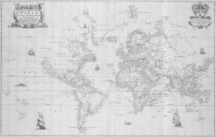
The Piri Reis Map is not a complete world map but a fragment, depicting the western coast of Africa, the eastern coast of South America, and a portion of what is believed to be the northern coast of Antarctica. Its survival is largely due to its discovery in 1929 at the Topkapi Palace library in Istanbul. The map is drawn on gazelle skin and measures approximately 90 cm by 63 cm. Accompanying marginal notes, inscribed by Piri Reis himself, provide invaluable insights into its compilation and the sources he utilized.
Piri Reis: A Pioneer of Ottoman Cartography
Piri Reis (c. 1470 – c. 1555), whose full name was Hadji Muhiddin Piri ibn Hadji Mehmed, was a prominent Ottoman admiral, geographer, and cartographer. His contributions to the field extend beyond this singular map, encompassing significant works like the Kitab-ı Bahriye (Book of Navigation), a comprehensive atlas of the Aegean and Mediterranean seas. His expertise in navigation and cartography was rooted in a practical understanding of the sea, honed through years of naval service. This background lends significant weight to the accuracy of his depictions.
Sources and Acknowledged Influences
In his marginal notes, Piri Reis explicitly states that his map was not a singular original work but a compilation drawn from approximately twenty different source maps. These sources included eight Ptolemaic maps (referring to the cartographic tradition established by Claudius Ptolemy in the 2nd century AD), four newly drawn Portuguese maps of the Indian Ocean and China, and an old map drawn by Christopher Columbus of the western lands. The mention of Columbus’s map is particularly intriguing, as no such complete map from Columbus is known to survive, making the Piri Reis Map a potential conduit to lost knowledge. Furthermore, Piri Reis highlights the use of “four Danish maps” and “ancient maps” – terms that have fueled much speculation due to their ambiguity. This eclectic mix of ancient and contemporary sources provides a lens through which to view the map’s complexities.
The Piri Reis map of 1513 has long intrigued historians and cartographers, particularly due to its depiction of Antarctica, which was not officially discovered until centuries later. This enigmatic map raises questions about the knowledge and capabilities of ancient civilizations. For those interested in exploring more about this fascinating topic, you can read a related article that delves into the mysteries surrounding the Piri Reis map and its implications on our understanding of historical geography. Check it out here: Piri Reis Map and the Antarctica Mystery.
The Enigmatic Southern Continent
The most contentious and captivating aspect of the Piri Reis Map lies in its depiction of a large southern landmass, positioned where Antarctica would eventually be discovered. What makes this representation so extraordinary is its seemingly accurate coastline beneath the Antarctic ice sheet, coupled with its portrayal as ice-free.
A Coastline Unveiled
The southern continent on the map displays topographical features that bear a resemblance to the Queen Maud Land and Princess Martha Coast regions of Antarctica. Researchers such as Professor Charles H. Hapgood suggested in the 1960s that the map accurately depicts the ice-free coastline of Antarctica, a coastline that would have been visible only prior to the last ice age, potentially tens of thousands of years ago. This claim is based on glaciological and seismic surveys conducted in the mid-20th century that revealed the underlying topography of Antarctica. If Hapgood’s interpretation holds true, it implies the existence of a highly advanced, unknown civilization capable of accurate global mapping at a time conventionally believed to be primitive.
The Ice-Free Paradox
The depiction of an ice-free Antarctica is a central pillar of the controversy. Geologically, Antarctica has been covered by ice for millions of years. The last major deglaciation event that could have rendered significant portions ice-free occurred approximately 12,000 to 15,000 years ago during the Younger Dryas period, and even then, only certain coastal areas might have been exposed. To suggest that a map from the 16th century could accurately portray an ice-free continent from such a distant past presents a profound challenge to conventional historical timelines and our understanding of ancient technology. This paradox acts as a siren call for those who believe in pre-diluvian civilizations or advanced ancient knowledge.
Explanations and Counter-Explanations
Numerous explanations have been put forth to account for this southern landmass. The more conventional explanations suggest that the land is not Antarctica at all but rather a misinterpretation or an artistic extension of the known South American coastline, in line with the common cartographic practice of terra incognita – filling in unknown areas with conjectural landmasses or extending known features. Others propose it might represent the mythical Terra Australis Incognita, a theoretical continent in the southern hemisphere that explorers long sought. However, these explanations often struggle to account for the surprising topographical resemblance.
Theories of Advanced Ancient Cartography
The Piri Reis Map has become a cornerstone for theories that posit the existence of advanced ancient civilizations with sophisticated geographical knowledge. These theories challenge conventional historical narratives and our understanding of human technological progression.
The Hapgood Hypothesis
Professor Charles H. Hapgood, an American professor of history and science, is perhaps the most prominent proponent of the “advanced ancient cartography” theory regarding the Piri Reis Map. His seminal work, Maps of the Ancient Sea Kings (1966), meticulously analyzed the map alongside other ancient charts, concluding that they were derived from a common, highly accurate source. Hapgood, with the assistance of MIT’s Captain Arlington H. Mallery, argued that the map employs spherical trigonometry and sophisticated projection methods, suggesting knowledge far beyond that of the 16th century. He proposed a shift-of-the-Earth’s-crust theory to explain the discrepancy in the Antarctic ice sheet, positing that a rapid pole shift could have temporarily exposed parts of the continent.
Implications of Pre-Glacial Knowledge
If Hapgood’s hypothesis were to be confirmed, the implications would be profound. It would necessitate a reconsideration of the capabilities of pre-historic societies, suggesting a level of global exploration and cartographic precision that is traditionally attributed to much later periods of human history. The “ancient mariners” concept, as envisioned by Hapgood, implies a lost civilization with navigational and surveying technologies capable of mapping the entire globe with astonishing accuracy, including areas that later became unnavigable due to glaciation. This would represent a fundamental shift in our understanding of human ingenuity and our timeline of scientific advancement.
The “Lost Civilization” Narrative
For many, the Piri Reis Map serves as a tantalizing clue to the existence of a long-lost, highly advanced civilization. This narrative often intersects with other theories of ancient mysteries, such as the construction of the Egyptian pyramids or the Nazca Lines. The map, in this context, becomes a fragment of a larger puzzle, indicating a shared, global knowledge base that was later lost or forgotten. Such theories, while captivating, often lack the robust archaeological and historical evidence required to shift scholarly consensus, yet they continue to fuel public imagination and attract considerable interest.
Skepticism and Alternative Interpretations

While the romantic notion of advanced ancient cartographers is compelling, a significant body of scholarly work offers more conventional, if less sensational, interpretations of the Piri Reis Map. These interpretations primarily focus on the limitations of 16th-century cartography and the known practices of compilation.
Cartographic Conventions of the Era
One major argument against the “accurate Antarctica” theory rests on the cartographic conventions prevalent in the early 16th century. It was common practice to draw hypothetical southern continents, often referred to as terra australis incognita, to balance the landmasses in the northern hemisphere, based on ancient Greek ideas of symmetry. This was not based on actual exploration but on philosophical and theoretical principles. Therefore, the southern landmass on the Piri Reis Map could simply be a conjectural representation, drawing upon existing geographical theories rather than direct observation. The fact that it bears some resemblance to Antarctica could be attributed to coincidence or a selective interpretation of imprecise data.
Misinterpretations of South American Coastline
Another prevalent theory suggests that the southern landmass is not Antarctica at all but a distorted or extended depiction of the South American coastline. The Amazon River and its delta could be misinterpreted as a strait, leading to an artificially elongated continent. Due to the projection methods used and the lack of precise longitude measurements, maps of this era often contained significant distortions, particularly in areas beyond the immediate reach of European exploration. Therefore, what appears to be a separate southern continent might simply be the result of combining imprecise data and extrapolating unknown territories. The “Chile bump” on the map, seemingly projecting too far south, is often cited as evidence for this interpretation.
The Role of Imagination and Speculation
It is crucial to remember that cartography in the 16th century was as much an art form as a science. Mapmakers often filled in gaps in their knowledge with educated guesses, mythical lands, or artistic embellishments. The Piri Reis Map, despite its remarkable accuracy in parts, may also contain elements of imagination and speculation. The precision attributed to certain features might be overstated, and the selection of evidence to support the “Antarctica” claim might suffer from confirmation bias. When viewing such historical artifacts, one must approach them with a critical eye, understanding the context of their creation and the limitations of the available information at that time.
The Piri Reis map of 1513 has long fascinated historians and researchers due to its detailed depiction of parts of the world that were not officially discovered at the time, particularly its controversial representation of Antarctica. This has led to numerous theories about ancient civilizations and their advanced knowledge of geography. For those interested in exploring more about this intriguing subject, you can read a related article that delves into the mysteries surrounding the Piri Reis map and its implications for our understanding of history. You can find it here: XFile Findings.
The Enduring Legacy of the Piri Reis Map
| Metric | Details |
|---|---|
| Map Name | Piri Reis Map |
| Year Created | 1513 |
| Cartographer | Piri Reis |
| Region Depicted | Western coasts of Europe, North Africa, and parts of the Americas |
| Antarctica Representation | Controversial; some claim it shows an ice-free Antarctica |
| Map Material | Gazelle skin parchment |
| Discovery Year | 1929 |
| Current Location | Topkapi Palace Museum, Istanbul, Turkey |
| Mystery Aspect | Possible depiction of Antarctica before official discovery; accuracy debated |
| Map Size | Approximately 90 cm x 65 cm |
The Piri Reis Map, even after five centuries, continues to serve as a powerful catalyst for historical inquiry and scientific debate. Its status as a historical artifact is undisputed, but its enigmatic contents continue to challenge preconceived notions about ancient knowledge and exploration.
A Mirror to Our Curiosity
The map acts as a mirror, reflecting our own curiosity about the unknown and our desire to uncover lost secrets. It invites us to question established narratives and to consider possibilities that lie beyond our current understanding. Whether one subscribes to the “advanced ancient civilization” theory or prefers more conventional explanations, the map forces a re-examination of historical evidence and the processes by which knowledge is acquired and transmitted across millennia. It compels us to consider the fluid nature of history itself, a tapestry woven with threads of fact, interpretation, and mystery.
The Ongoing Quest for Answers
The debate surrounding the Piri Reis Map is far from settled. New archaeological discoveries, advancements in glaciology, and further historical analysis continue to refine our understanding of both ancient cartography and global geography. The map remains a testament to the enduring allure of unsolved mysteries, a siren call for scholars, adventurers, and enthusiasts alike to delve deeper into the archives of human history. Its cryptic lines and compelling notes serve as a perpetual reminder that the past often holds more secrets than we realize, waiting for the right key to unlock them. The Piri Reis Map stands not just as a cartographic artifact, but as a perpetual challenge to our collective knowledge, a silent witness to a history potentially far richer and more complex than we currently comprehend.
FAQs
What is the Piri Reis map of 1513?
The Piri Reis map is a world map created in 1513 by the Ottoman admiral and cartographer Piri Reis. It is notable for its detailed depiction of parts of the western coasts of Europe, North Africa, and the coast of Brazil in South America.
Why is the Piri Reis map associated with Antarctica?
The map includes a southern landmass that some researchers have speculated resembles the coastline of Antarctica. This has led to theories that the map shows Antarctica before it was covered by ice, although mainstream historians and geographers generally dispute this interpretation.
What makes the Piri Reis map mysterious?
The mystery stems from the map’s accuracy in depicting certain coastlines and the inclusion of a southern continent, which some claim predates the official discovery of Antarctica. The sources Piri Reis used and how he obtained such detailed information remain subjects of debate.
What sources did Piri Reis use to create his map?
Piri Reis stated that he compiled his map using about 20 different maps and charts, including some from the time of Alexander the Great, Portuguese maps, and possibly maps from earlier explorers. However, the exact nature and origin of these sources are not fully known.
Is the Piri Reis map considered accurate by modern standards?
While the map is impressive for its time and shows a relatively accurate depiction of some coastlines, it does not meet modern cartographic standards. Many of its features are open to interpretation, and some claims about its accuracy, especially regarding Antarctica, are considered speculative.