
The Piri Reis map, a singular artifact discovered in the early 20th century, presents a historical and cartographical enigma. Its purported accuracy in depicting landmasses, particularly Antarctica, has propelled it into the realm of popular fascination, sparking debate and speculation regarding its origins and the knowledge possessed by its creator. This article aims to examine the Piri Reis map through a factual lens, exploring its historical context, the elements that have fueled its “surprising revelations,” and the prevailing scholarly interpretations.
The Cartographer and His Time
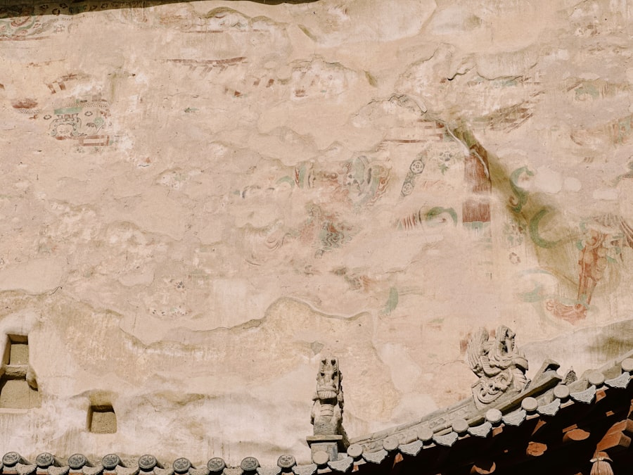
The map is attributed to Piri Reis, an Ottoman admiral and cartographer who lived in the first half of the 16th century. Born in Gallipoli, Ottoman Empire, around 1465, Piri Reis was an accomplished sailor and held a high rank within the Ottoman navy. His career involved naval expeditions and strategic planning, providing him with a unique perspective on maritime knowledge. His firsthand experience at sea undoubtedly contributed to his cartographical endeavors. The map itself is dated 1513 and was presented to Sultan Selim I. It is a segment, or parca, of a larger world map, of which only this portion has survived. The surviving fragment depicts the western coasts of Europe and North Africa, and the eastern coast of South America.
The Historical Context of Early Cartography
The early 16th century was a period of immense exploration and burgeoning cartographical development. European powers were actively seeking new trade routes and territories, leading to a rapid accumulation of geographical information. Christopher Columbus’s voyages, beginning in 1492, had profoundly reshaped the understanding of the Western Hemisphere. Likewise, Portuguese explorations charted extensive coastlines in Africa and Asia. Cartographers of this era were tasked with synthesizing this new and often contradictory information into coherent maps, a process that was inherently challenging and prone to inaccuracies. Maps were not static representations but living documents, constantly being updated as new discoveries came to light. The Piri Reis map emerges from this fertile ground of exploration and information synthesis.
Piri Reis’s Own Account
Crucially, Piri Reis did not claim sole authorship of the information contained within his map. In accompanying notes inscribed on the map itself, he states that he compiled it from approximately twenty different charts and maps, including Arab, Indian, Portuguese, and even maps drawn by Columbus himself. This assertion is a vital piece of information, as it suggests that Piri Reis was not an independent discoverer of new lands but rather a synthesizer of existing, albeit varied, geographical knowledge. The quality and reliability of these source maps would have been a significant factor in the accuracy of his own compilation.
The Piri Reis map, created in 1513, has long intrigued historians and cartographers due to its detailed depiction of the South American coastline and the controversial representation of Antarctica, which was not officially discovered until the 19th century. For a deeper exploration of this fascinating topic, you can read the article on the X File Findings website that discusses the implications of ancient maps and their potential connections to lost civilizations. You can find it here: X File Findings.
The “Surprising Revelation”: Antarctica on the 1513 Map?
The Controversial Depiction of Antarctica
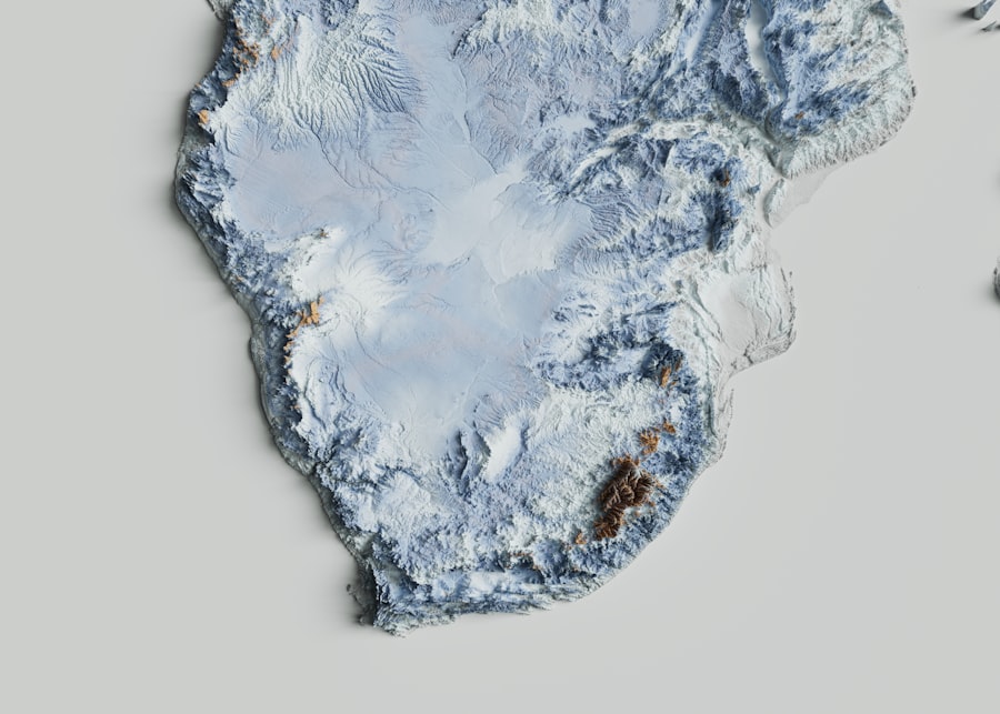
The most widely discussed and debated aspect of the Piri Reis map is its alleged depiction of Antarctica, specifically its coastline, surprisingly free of ice. Proponents of the “surprising revelation” theory argue that the southern portion of the map clearly shows a landmass that corresponds to the Antarctic continent. They point to features and outlines that, when compared with modern geological surveys, bear a striking resemblance to the coastline of Antarctica. The absence of ice in this depiction is particularly noteworthy, as Antarctica has been covered in ice for millennia.
The Ice-Free Continent Theory
The central tenet of the Piri Reis map’s controversial interpretation is the idea that the continent of Antarctica was ice-free and potentially habitable at some point in the distant past, and that this ancient geographical knowledge was somehow preserved and accessed by Piri Reis or his sources. This theory suggests a level of geographical knowledge far exceeding that of the early 16th century, implying either advanced ancient civilizations with sophisticated cartographical abilities or some form of unexplainable transmission of knowledge across vast epochs.
Geographical Analysis and Modern Comparisons
To support the claim of an Antarctic depiction, researchers have painstakingly compared the outlines on the Piri Reis map with modern geographical data. When projected onto a consistent scale and orientation, the southern extremities of the map indeed display landforms that bear a superficial resemblance to the eastern coast of South America and what would be the northernmost reaches of Antarctica’s Enderby Land and Queen Maud Land. The remarkable correlation, proponents argue, is too precise to be a mere coincidence, transcending typical cartographical errors of the time.
Examining the Evidence: Scholarly Interpretations
The Mainstream Cartographical View
The prevailing view among mainstream cartographers and historians of cartography is that the Piri Reis map, while a remarkable compilation for its time, does not definitively depict Antarctica. Scholars argue that the landmass in question is more likely a misinterpretation or a combination of several known landmasses. They propose that the southern portions of the map could represent the coast of Brazil, the continent of South America, or possibly even a speculative southern continent that was theorized to exist in ancient and medieval times, known as Terra Australis Incognita. The belief in a large southern landmass was a common cartographical convention, a placeholder for the unknown south.
The “Misinterpretation” Hypothesis
According to this perspective, the apparent congruity with Antarctica arises from a selective interpretation of the map and an over-reliance on modern geographical data. The coastline depicted is imprecise and fragmented, leaving ample room for projection and alignment to create perceived similarities. Furthermore, it is argued that the map’s projection or scale could be distorted, leading to erroneous comparisons. The absence of ice, in this view, is simply a consequence of the mapmaker not having reliable information about the southern polar regions and drawing what they imagined or what was suggested by earlier, possibly speculative, maps.
The “Ancient Knowledge” Hypothesis
A more fringe, yet persistent, interpretation suggests that the map represents ancient knowledge, potentially pre-dating known civilizations. This hypothesis posits that Piri Reis had access to charts created by a much older, advanced civilization that possessed a comprehensive understanding of global geography, including Antarctica. This unknown civilization could have mapped the continent before it was covered by ice, and these charts were somehow preserved and passed down through various cultures until reaching Piri Reis. This theory, while intriguing, lacks direct evidence and relies heavily on speculation about lost civilizations and forgotten knowledge.
Debunking the “Ice-Free Antarctica” Claims
Geographical Inconsistencies and Source Material Limitations
When subjected to rigorous geographic analysis, the claims of an ice-free Antarctica depicted on the Piri Reis map begin to fray like an old sail. Modern cartographic studies, employing advanced geospatial analysis techniques, have highlighted significant inconsistencies with Antarctica’s actual geography, even when considering the theoretical “ice-free” state. The coastlines, while bearing some resemblance, are not an exact match. Features that would be expected, given an ice-free landmass, are absent or misrepresented. Moreover, the identified source maps, as mentioned by Piri Reis himself, were a collection of fragmented and often speculative texts. It is highly improbable that among these sources, a single, accurate, and detailed map of an ice-free Antarctica existed and was seamlessly integrated.
The Scale and Projection Conundrum
One of the primary challenges in verifying the Antarctic depiction lies in the map’s scale and projection. The Piri Reis map is not a true Mercator projection, which became standard much later. The early 16th-century maps often employed various, less precise projections. Interpreting and comparing these early maps with modern projections requires careful consideration of distortion and scale shifts. Without a definitive understanding of the projection used by Piri Reis and his sources, aligning the southern landmass with Antarctica becomes a matter of educated guesswork, prone to subjective interpretation. The perceived accuracy can be a ghost in the machine, an illusion created by careful manipulation of scales and angles.
The Role of Terra Australis Incognita
The concept of a vast southern continent, Terra Australis Incognita, was a well-established idea among geographers and cartographers for centuries. This hypothetical landmass was believed to balance the known continents in the Northern Hemisphere and was often depicted on maps, even before any significant exploration of the southern polar regions. It is far more plausible that the landmass shown on the southern part of the Piri Reis map is a representation of this theoretical continent rather than an accurate depiction of ice-free Antarctica. Its placement and general shape align with the common cartographical conventions of the time when visualizing this unknown southern land.
The Piri Reis map has long fascinated historians and cartographers due to its detailed depiction of the world as it was known in the early 16th century, including what some believe to be the coastline of Antarctica, long before it was officially discovered. This intriguing aspect of the map raises questions about ancient knowledge and exploration, which can be further explored in a related article that delves into the mysteries surrounding historical maps and their implications. For more insights, you can read the article here.
The Piri Reis Map’s Enduring Legacy
| Aspect | Details |
|---|---|
| Map Name | Piri Reis Map |
| Date Created | 1513 |
| Region Depicted | Western coasts of Europe, North Africa, and the coast of South America; some interpretations suggest Antarctica |
| Antarctica Representation | Some claim the map shows the northern coastline of Antarctica free of ice, though this is debated |
| Source Materials | Compiled from about 20 older maps, including possibly ancient maps and charts from explorers |
| Accuracy | Coastlines are surprisingly accurate for the time, but Antarctica’s depiction is controversial and not confirmed |
| Significance | Suggests advanced geographical knowledge in the early 16th century; fuels theories about pre-modern exploration |
| Controversy | Scholars debate whether the map truly shows Antarctica or misinterpreted South American coastlines |
A Testament to Early Cartography
Regardless of whether it depicts Antarctica or not, the Piri Reis map remains an extraordinary artifact. It stands as a remarkable testament to the cartographical ambitions and the diligent compilation efforts of the early 16th century. The map showcases the breadth of geographical knowledge available at the time, pieced together from various sources, reflecting the nascent stages of global cartography. It offers a fascinating glimpse into how the world was perceived and represented by seasoned mariners and scholars during a period of intense global exploration. The map is a historical snapshot, a frozen moment in the evolution of geographical understanding.
The Allure of Mystery and Unconventional Interpretations
The Piri Reis map’s enduring appeal lies in its inherent mystery and the fertile ground it provides for unconventional interpretations. The notion of a lost ancient civilization or incredibly advanced pre-modern knowledge is a compelling narrative that captures the imagination. This intrigue fuels continued research and discussion, pushing the boundaries of historical and geographical inquiry. While mainstream scholarship may offer more grounded explanations, the romantic allure of the Piri Reis map as a potential harbinger of unknown truths ensures its place in popular discourse and historical fascination. The map is a siren song, calling to the explorer in every observer.
Future Directions and Ongoing Research
Ongoing research into the Piri Reis map continues, with scholars employing new analytical tools and historical methodologies. Advanced imaging techniques can reveal finer details of the map and its inscriptions, while comparative studies with other early maps are constantly refining our understanding of its origins and influences. The quest to definitively understand the Piri Reis map is not simply about settling a historical debate; it is about enriching our comprehension of the past, the evolution of human knowledge, and the enduring human drive to explore and understand the world around us. The map continues to be a compass, pointing towards further discovery.
FAQs
What is the Piri Reis map?
The Piri Reis map is a world map created in 1513 by the Ottoman admiral and cartographer Piri Reis. It is famous for its detailed depiction of parts of the Americas, Europe, and Africa, and is one of the earliest maps to show the New World.
Does the Piri Reis map actually show Antarctica?
The Piri Reis map does not explicitly label Antarctica. However, some researchers argue that the southernmost landmass depicted on the map resembles the northern coastline of Antarctica, as it might have been ice-free at the time. This interpretation is debated among historians and cartographers.
How could Piri Reis have mapped Antarctica before its official discovery?
Some theories suggest that Piri Reis used older maps from ancient civilizations or explorers who may have had knowledge of Antarctica before it was officially discovered in 1820. However, there is no definitive evidence to confirm that Antarctica was mapped accurately before modern exploration.
What sources did Piri Reis use to create his map?
Piri Reis compiled his map using a variety of sources, including Portuguese, Spanish, and Arabic maps, as well as charts from earlier explorers. He himself noted that he used about 20 different maps and charts, some of which dated back to the time of Alexander the Great.
Why is the Piri Reis map significant in the study of cartography?
The Piri Reis map is significant because it provides insight into early 16th-century geographic knowledge and the blending of different cultural sources in mapmaking. It also raises intriguing questions about the extent of ancient exploration and the accuracy of early maps, especially regarding the depiction of the Americas and possibly Antarctica.