The archaeological landscape, traditionally confined to the trowel and excavation pit, has undergone a profound transformation in recent decades. The advent of satellite-precision mapping technologies has opened a new vista onto the ancient world, allowing researchers to perceive and interpret past human activities with unprecedented detail and scope. This paradigm shift moves beyond the limitations of ground-based surveys, providing a birds-eye view that reveals patterns and structures previously invisible or misinterpreted.
The application of remote sensing in archaeology is not a fleeting trend but a fundamental evolution in methodology. Its origins can be traced to aerial photography, which, even in its nascent stages, provided a novel perspective on ancient sites. However, the true revolution began with the integration of satellite technology.
From Aerial Photography to Space-borne Sensors
Early archaeological reconnaissance often relied on opportunistic aerial photographs, which occasionally revealed crop marks or soil discolorations indicative of buried structures. These initial forays, while insightful, were often limited by weather conditions, flight path constraints, and the inherent subjectivity of visual interpretation.
The Satellite Advantage: A Wider, Deeper Gaze
Satellites, orbiting hundreds of kilometers above the Earth’s surface, offer a consistent and repeatable platform for data acquisition. Their vast coverage capabilities allow for the systematic mapping of entire regions, transcending national borders and challenging terrains that would be impossible or prohibitively expensive to survey on the ground. This panoramic view provides a contextual understanding of ancient settlements within their broader environmental and geopolitical landscapes, moving beyond the isolated study of individual sites.
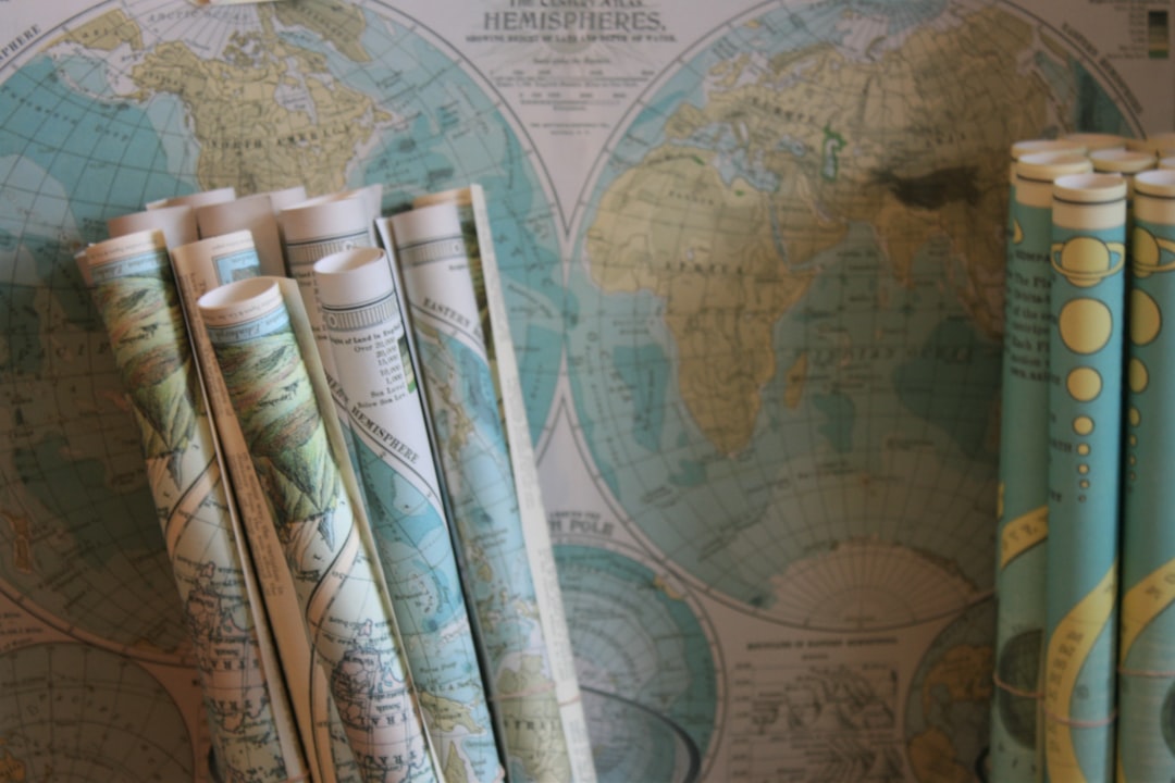
Ancient maps have long fascinated historians and cartographers alike, offering a glimpse into how civilizations understood and represented their world. A recent article explores the intersection of these historical artifacts with modern technology, showcasing how satellite precision can enhance our understanding of ancient cartography. By analyzing ancient maps through satellite imagery, researchers can uncover hidden features and gain insights into the geographical knowledge of past cultures. For more on this intriguing topic, you can read the full article here: Ancient Maps with Satellite Precision.
A Toolkit of Techniques: Peering Through Time and Terrain
The term “satellite-precision mapping” encompasses a diverse array of technologies, each offering unique capabilities for archaeological investigation. Understanding these tools is crucial to appreciating the depth and breadth of information they can provide.
Spectral Analysis: Unveiling Hidden Signatures
Different materials on Earth reflect and absorb electromagnetic radiation in distinct ways, creating unique spectral signatures. Satellite sensors, equipped to detect these variations across multiple wavelengths, can differentiate between natural geology and anthropogenic alterations.
Multispectral and Hyperspectral Imaging
Multispectral imaging captures data in a limited number of broad spectral bands, typically in the visible, near-infrared (NIR), and short-wave infrared (SWIR) ranges. This allows archaeologists to identify subtle differences in vegetation health, soil composition, and even the presence of certain minerals associated with ancient human activity. For example, changes in vegetation stress caused by underlying foundations can be detected through variations in NIR reflectance. Hyperspectral imaging takes this a step further, collecting data across hundreds of narrow, contiguous spectral bands, providing a far more detailed spectral fingerprint of the surface. This increased spectral resolution can differentiate between very similar materials and offer insights into ancient land use, agriculture, and resource extraction.
Thermal Infrared Sensing: Reading the Heat of the Past
Thermal infrared sensors measure the heat radiation emitted from the Earth’s surface. Different materials heat up and cool down at varying rates, creating thermal anomalies that can reveal buried features. Stone foundations, for instance, retain heat longer than disturbed soil, making them visible in thermal imagery even when hidden beneath the surface. This technique is particularly effective in arid environments where temperature differences are more pronounced. Consider a Roman road buried beneath sand; its dense construction would likely retain heat differently from the surrounding loose sand, creating a detectable thermal signature.
Topographic Reconstruction: Sculpting the Ancient Landscape
Understanding the three-dimensional form of the landscape is paramount in archaeological interpretation. Satellite-based topographic mapping techniques allow for the creation of incredibly detailed elevation models.
Digital Elevation Models (DEMs) and Digital Surface Models (DSMs)
DEMs represent the bare earth’s elevation, removing features like trees and buildings. DSMs, on the other hand, include these surface features. Both are crucial for identifying subtle changes in topography that may indicate ancient earthworks, irrigation canals, road networks, or even the remnants of collapsed buildings. The precision of these models allows archaeologists to virtually walk through ancient landscapes, discerning patterns in land use and settlement planning that would be impossible to detect at ground level. Imagine a subtle rise in terrain, barely perceptible to the naked eye. A high-resolution DEM can reveal it as a meticulously engineered defensive rampart or a monumental platform.
Light Detection and Ranging (LiDAR) from Space
LiDAR, originally developed for airborne platforms, is now being deployed on satellites. This technology uses laser pulses to measure distances, creating highly accurate and dense point clouds of the Earth’s surface. The ability of LiDAR to penetrate dense vegetation, such as rainforests, is revolutionizing the discovery of lost cities and settlements in areas previously deemed impenetrable. It’s like peeling back a blanket of foliage to reveal the architectural secrets beneath. Consider the hidden Mayan cities in Mesoamerica, where LiDAR has unveiled vast urban centers and intricate agricultural systems effectively invisible from the ground.
Data Processing and Interpretation: From Raw Pixels to Ancient Stories

The raw data acquired from satellites is a deluge of numbers and electromagnetic signals. Transforming this data into meaningful archaeological insights requires sophisticated processing and interpretation techniques.
Geospatial Information Systems (GIS): The Archaeologist’s Workbench
GIS software serves as the central hub for integrating, analyzing, and visualizing various layers of satellite data. It allows archaeologists to overlay different spectral bands, elevation models, historical maps, and even the results of ground-based surveys. This multi-layered approach enables complex spatial analysis, identifying correlations and patterns that might escape individual examination. For example, a GIS can be used to analyze the relationship between ancient settlements and water sources, or to model the potential visibility of watchtowers across a landscape.
Machine Learning and Artificial Intelligence: Automating Discovery
The sheer volume of satellite data necessitates advanced analytical tools. Machine learning algorithms are being trained to identify archaeological features automatically, such as individual house foundations, field systems, or even specific pottery concentrations. By recognizing patterns in spectral signatures and topographic anomalies, AI can accelerate the discovery process and reduce the manual effort required for feature extraction. This is not about replacing human ingenuity, but about augmenting it, allowing archaeologists to focus on interpretation rather than repetitive data sorting. Consider a neural network trained to identify the distinctive square outlines of Roman villas in satellite imagery across millions of square kilometers, a task impossible for a human team in any reasonable timeframe.
Case Studies: Illuminating the Past, Present, and Future

The impact of satellite-precision mapping is evident in numerous archaeological discoveries across the globe, fundamentally reshaping our understanding of ancient civilizations.
Unveiling Lost Cities in the Amazon
For decades, the Amazon rainforest was considered a pristine wilderness, sparsely populated before European contact. Satellite LiDAR has dramatically challenged this notion, revealing intricate networks of settlements, earthworks, and agricultural systems hidden beneath the dense canopy. These discoveries indicate a far more complex and densely populated Amazonian past than previously imagined, forcing a reassessment of indigenous societal organization and environmental impact. The image of the “noble savage” has been replaced by evidence of sophisticated engineering and urban planning.
Rediscovering Roman Road Networks and Settlements
In Europe, satellite imagery has provided a comprehensive view of ancient Roman infrastructure. Crop marks visible from space have revealed the precise routes of Roman roads, villas, and military encampments previously known only from fragmentary literary sources or localized excavations. This macro-level perspective allows researchers to understand the strategic planning behind Roman expansion and the interconnectedness of their vast empire. It’s like seeing the entire blueprint of an ancient superpower, rather than just isolated fragments.
Mapping Ancient Irrigation Systems in Arid Lands
In arid regions such as the Arabian Peninsula and the Near East, satellite imagery is crucial for identifying ancient irrigation systems, terraced fields, and water management structures. These subtle features, often eroded or buried by sand, become visible through advanced spectral analysis and topographic modeling. These discoveries contribute significantly to our understanding of ancient agricultural practices, resilience in challenging environments, and the long-term human adaptation to climate change. The lines etched by ancient canals, though faint, tell stories of ingenious survival.
Ancient maps have long fascinated historians and cartographers, revealing how civilizations understood their world. Recent advancements in technology allow us to analyze these historical documents with satellite precision, uncovering details that were previously overlooked. For a deeper exploration of this topic, you can read a related article that delves into the intersection of ancient cartography and modern technology. This insightful piece highlights how satellite imagery is transforming our understanding of historical maps and their significance. To learn more, check out the article here.
Challenges and Ethical Considerations: Navigating the New Frontier
| Map Name | Origin | Approximate Date | Precision Level | Notable Features | Modern Satellite Comparison Accuracy |
|---|---|---|---|---|---|
| Piri Reis Map | Ottoman Empire | 1513 | High for its time | Coastlines of South America and Africa, Antarctica depiction | Within 10-15 km of modern satellite data |
| Tabula Rogeriana | Arab World (Al-Idrisi) | 1154 | Moderate | Detailed Mediterranean and African coastlines | Within 50-70 km of modern satellite data |
| Fra Mauro Map | Venice, Italy | 1450 | High | Detailed Eurasian and African geography | Within 20-30 km of modern satellite data |
| Chinese Yu Ji Tu | China | 1137 | Moderate to High | Accurate depiction of Chinese provinces and rivers | Within 30-40 km of modern satellite data |
| Mercator’s World Map | Flemish (Gerardus Mercator) | 1569 | Very High | First map with accurate projection for navigation | Within 5-10 km of modern satellite data |
While satellite-precision mapping offers immense potential, it also presents a new set of challenges and ethical considerations that archaeologists must address.
Data Accessibility and Technical Expertise
Access to high-resolution satellite imagery and the necessary software and computational power can be a significant barrier for many research teams, particularly those in developing countries. Furthermore, interpreting complex remote sensing data requires specialized training and expertise, creating a skills gap in some archaeological communities. This necessitates efforts towards democratizing access and knowledge transfer.
The Problem of “Seeing Without Touching”
Remote sensing, by its very nature, provides an indirect view of the past. While it can identify features, it cannot replace the nuanced information gained through excavation, such as stratigraphy, artifact analysis, and environmental data. There is a risk of over-reliance on remote sensing without sufficient ground-truthing, leading to potential misinterpretations. It’s akin to reading a book’s cover without ever opening its pages.
Ethical Implications of Discovery and Disclosure
The discovery of previously unknown archaeological sites, particularly those in vulnerable regions or within the territories of indigenous communities, raises important ethical questions. Issues of cultural heritage management, potential looting, and the rights of indigenous peoples must be carefully considered before publicizing sensitive findings. The power to reveal comes with the responsibility to protect. Furthermore, the commercialization of satellite data and the potential for its misuse, even by well-intentioned researchers, necessitates robust ethical frameworks. The lens of the satellite offers power, and power demands responsibility.
The Future of Satellite Archaeology: A Constellation of Possibilities
The field of satellite-precision mapping is continually evolving, with new technologies and methodologies emerging at a rapid pace.
Enhanced Resolution and Sensor Capabilities
Future satellite missions will likely deliver even higher spatial and spectral resolution, allowing for the detection of even finer details on the Earth’s surface. Advances in synthetic aperture radar (SAR) will improve subsurface penetration, enabling archaeologists to “see” through soil and even thin layers of water. Imagine a future where we can detect the precise outlines of house foundations meters beneath the surface, without moving a single grain of dirt.
Integration with Other Technologies: A Holistic Approach
The true power of satellite archaeology lies in its integration with other digital technologies. Augmented reality (AR) and virtual reality (VR) can allow researchers and the public to virtually explore ancient landscapes reconstructed from satellite data. The combination of satellite imagery with drone-based surveys and advanced geophysical techniques will create a multi-scale, multi-sensor approach to archaeological investigation, offering an unprecedented level of detail and understanding. It’s building a grand tapestry of the past, woven from countless threads of data.
Global Monitoring and Heritage Protection
Satellite-precision mapping is not only a tool for discovery but also an increasingly vital instrument for heritage protection. By regularly monitoring known archaeological sites, researchers can detect illegal looting, encroachment, and damage caused by natural disasters or conflict. This provides an early warning system, allowing for timely intervention and preservation efforts. The satellite becomes a vigilant guardian, watching over the vulnerable remnants of human history.
In conclusion, satellite-precision mapping has irrevocably altered the landscape of archaeological research. It has transformed our ability to detect, interpret, and protect the tangible vestiges of ancient civilizations, offering a scope and depth previously unimaginable. As technology continues to advance, the ancient world will continue to reveal its secrets from above, inviting researchers and the public alike to embark on an ever more detailed journey into the human past. The silent gaze from space is steadily illuminating the whispers of history.
FAQs
What are ancient maps with satellite precision?
Ancient maps with satellite precision refer to historical maps or cartographic representations that show an unexpectedly high level of accuracy, comparable to modern satellite imagery. These maps often depict geographical features with precise details that challenge our understanding of ancient surveying and mapping techniques.
How were ancient maps created with such accuracy?
While the exact methods remain a subject of research and debate, it is believed that ancient civilizations used advanced surveying tools, astronomical observations, and geometric calculations to create detailed maps. Some theories suggest the use of early forms of triangulation and careful measurements of distances and angles.
Which ancient maps are known for their high precision?
Notable examples include the Piri Reis map from the 16th century, which shows parts of the Americas with remarkable detail, and the Babylonian World Map, which provides a surprisingly accurate depiction of the known world at the time. Other examples include maps from ancient Egypt, Greece, and China that demonstrate sophisticated cartographic knowledge.
What is the significance of ancient maps with satellite-level accuracy?
These maps provide insight into the advanced scientific and navigational knowledge of ancient cultures. They challenge modern assumptions about the technological capabilities of early civilizations and contribute to our understanding of historical geography and exploration.
Are there any controversies surrounding ancient maps with satellite precision?
Yes, some scholars question the authenticity or interpretation of these maps, suggesting that modern readings may overstate their accuracy. Others propose alternative explanations, such as later modifications or coincidences in map features. The debate continues as new discoveries and technologies allow for better analysis of these ancient documents.