Imagine, if you will, maps crafted not with the familiar precision of satellite imagery or even the careful geodesy of the Enlightenment, but with an accuracy that seems to defy the known technological capabilities of their purported creators. These aren’t fantasy concoctions or speculative drawings; they are tangible artifacts, cartographic anomalies that for centuries have presented a perplexing challenge to conventional historical narratives. When one examines these ancient maps, a recurring question emerges: how did their makers possess such detailed geographical knowledge? This article will delve into several prominent examples of these maps, exploring the arguments surrounding their origins and the tantalizing possibility that they represent evidence of external influence, whether through direct contact or the transmission of advanced knowledge.
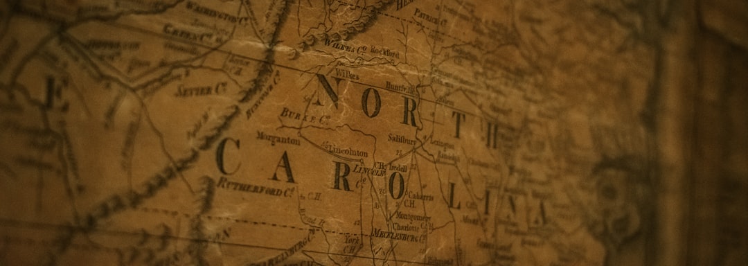
The Piri Reis Map, compiled in 1513 by the Ottoman admiral and cartographer Piri Reis, stands as one of the most compelling pieces of evidence for anomalous ancient cartography. Discovered in 1929 in the Topkapı Palace library in Istanbul, this map depicts parts of the western coast of Africa, the eastern coast of South America, and a northern coastline of Antarctica, years before its official discovery.
Uncanny Accuracy of the Antarctic Coastline
Perhaps the most astonishing feature of the Piri Reis map is its depiction of a portion of Antarctica, seemingly ice-free. Mainstream understanding suggests that Antarctica has been covered by ice for millions of years, with its coastline only mapped with precision by modern seismic sounding techniques. The map’s portrayal of this landmass has led to intense speculation.
- Olson’s Interpretation: Arlington H. Mallery, a former officer in the United States Navy and an amateur cartographer, along with Professor Charles H. Hapgood of Keene State College, brought the Piri Reis map to international attention. Hapgood’s analysis, conducted with the assistance of Mallery and other colleagues, suggested that the map meticulously detailed the Queen Maud Land region of Antarctica, free of its ice sheet. They proposed that the original source maps must have been compiled during an ice-free period for Antarctica, an epoch far predating human civilization as we understand it.
- Geological Discrepancies: The geological record indicates that Antarctica has been glaciated for at least 15 million years. If the map truly depicts an ice-free coastline, it implies a source of knowledge from an era when such conditions prevailed. This presents a considerable challenge to established timelines of human exploration and technological development.
Sources and Transmission of Knowledge
Piri Reis himself stated that his map was compiled from a set of approximately twenty older maps, some dating back to the time of Alexander the Great. He mentioned using a map “drawn by Columbus” and “ancient maps of the Indians.” This acknowledgment of older sources is critical.
- The “Columbus Map” Theory: While a map purportedly drawn by Columbus is mentioned, its exact nature and the extent of its contribution to the Piri Reis map remain subjects of debate. It is plausible that Columbus, during his voyages, encountered indigenous peoples who possessed their own cartographic traditions, potentially built upon generations of accumulated knowledge.
- Lost Libraries and Civilizations: The reference to maps from antiquity raises the intriguing possibility of significant repositories of geographical knowledge that have since been lost to history. This concept serves as a metaphorical wellspring of information, from which later civilizations might have drawn. Could these older maps have originated from highly advanced, yet now vanished, civilizations?
Ancient maps serve as fascinating artifacts that reveal not only geographical knowledge but also the influence of external cultures on the civilizations that created them. A related article discusses how these maps provide evidence of trade routes and interactions between different societies, highlighting the exchange of ideas and goods across vast distances. For more insights into this topic, you can read the article at X File Findings.
The Oronteus Finaeus Map: A Southern Continent Revealed
Another map that sparks considerable debate is the Oronteus Finaeus (Oronce Finé) map of 1531. This cordiform (heart-shaped) world map also depicts a large landmass in the southern hemisphere, labelled “Terra Australis Incognita,” with considerable detail that some argue astonishingly matches modern cartography of Antarctica.
Detailed Topography and Rivers
Similar to the Piri Reis map, the Oronteus Finaeus map shows topographical features that suggest a landmass free of its current ice sheet. It outlines mountain ranges, river systems, and coastal details that were not officially charted until centuries later.
- Hapgood’s Analysis of Oronteus Finaeus: Professor Hapgood, extending his research from the Piri Reis map, also studied the Oronteus Finaeus map. He concluded that the landmass shown corresponds closely to the actual contours of Antarctica, particularly the areas around the Ross Sea and Wilkes Land. The depiction of rivers flowing through what are now ice-covered regions further reinforces the notion of an ice-free continent.
- The ‘Pre-Glacial’ Hypothesis: The consistent depiction of an ice-free Antarctica across multiple ancient maps leads to a compelling, albeit controversial, hypothesis: that these maps draw from much older source material, originating from a time before the continent was enveloped in ice. This implies a significant re-evaluation of the capabilities and extent of ancient civilizations or, indeed, the presence of non-human intelligence with global cartographic abilities.
The Paradox of Precision
The accuracy of these maps, given the navigational tools available in the 16th century, presents a significant paradox. The concept of longitude, for example, was notoriously difficult to determine accurately until the development of reliable chronometers in the 18th century. Yet, some of these ancient maps show remarkable precision in longitudinal placement.
- Advanced Cartographic Principles: If these maps are genuinely accurate representations of remote continents, it suggests that their original creators possessed advanced cartographic principles, possibly including spherical trigonometry and highly accurate methods for determining latitude and longitude. Such knowledge would be, in essence, a beacon of advanced learning in an otherwise technologically nascent world.
- Lost Technologies and Instruments: The possibility exists that the creators of the original source maps possessed instruments and techniques for surveying and navigation that have since been lost to recorded history. This concept resonates with the idea of ‘lost technologies’ often associated with ancient advanced civilizations.
The Mercator Maps: Echoes of the Past
Gerard Mercator, the renowned Flemish cartographer, also produced world maps in the mid-16th century that present intriguing details, particularly concerning the Arctic region. His 1569 world map, famous for the Mercator projection, includes peculiar features in the high north.
The Arctic Archipelago and Hydrographic Details
Mercator’s maps depict an ice-free Arctic with a central, whirlpool-like ocean surrounded by four large islands, separated by wide rivers. This imagery is strikingly different from the ice-bound Arctic we know today.
- The “Magnetic Mountain” of Mercator: Mercator’s portrayal of a large, black, magnetic rock in the pole, around which the waters supposedly swirl, adds to the enigmatic nature of his Arctic depiction. While this specific detail might be mythological, the overall configuration of an ice-free Arctic archipelago aligns with some theories about past climatic conditions.
- Geological Evidence of an Ice-Free Arctic: Geological studies suggest that parts of the Arctic, specifically some landmasses that are now submerged or ice-covered, were indeed ice-free during warmer climatic periods, potentially many thousands of years ago. If Mercator’s sources reflect this, it again points to information passed down through immense stretches of time.
The Problem of Projective Distortion
While Mercator’s projection revolutionized navigation, it also introduced significant distortions, particularly at the poles. However, the details of the landmasses themselves, independent of projection, are the focus of scrutiny.
- Pre-Mercator Sources: It is acknowledged that Mercator, like Piri Reis, based his maps on a multitude of older sources, some of which he himself compiled over decades. The question remains: how far back do these sources truly go, and what level of detail did they contain regarding remote and difficult-to-access regions?
- Cumulative Knowledge: The persistence of these unusual geographical features across different cartographers and centuries suggests a continuity of a knowledge base, much like a river that flows through time, carrying sediment from disparate epochs. This continuity challenges the idea of independent discovery in each instance.
The Zeno Map: A Controversial Atlantic Tale
The Zeno map, published in 1558 by the Zeno brothers, purporting to be based on expeditions in the late 14th century, depicts islands in the North Atlantic that no longer exist or are significantly altered. Its inclusion here is due to its controversial nature and association with lost landmasses.
Frisland and Other Vanished Islands
The map vividly portrays a large island named “Frisland,” located south of Iceland, and other islands that are either misidentified landmasses, phantom islands, or, more controversially, land that has submerged.
- Submarine Topography: Some researchers have suggested that the outlines of these vanished islands on the Zeno map correspond with submarine topographical features in the North Atlantic, implying an awareness of landforms that were either above water in the distant past or were mapped using methods unknown to conventional history.
- Nautical Knowledge of Ancient Mariners: If the Zeno map reflects genuine, albeit lost, landforms, it points to remarkable nautical knowledge and exploration capabilities in periods traditionally considered less sophisticated. It presents a scenario where ancient mariners were far more capable than often assumed, venturing into distant and dangerous waters.
The Forgery Debate
The Zeno map has been subject to extensive debate, with many historians concluding it to be a forgery, a deliberate attempt to legitimize the supposed voyages. However, even within this debate, the existence of its detailed, yet anomalous, features fuels the discussion about hidden geographical knowledge.
- The ‘Authentic Core’ Argument: Despite the forgery claims, some argue that the Zeno map might contain an “authentic core” of older geographical knowledge, perhaps derived from actual, but otherwise undocumented, voyages or even older cartographic sources, which the Zenos then embellished or distorted. This is akin to a kernel of truth encased in layers of apocrypha.
- Cultural Transmission of Lore: Even if purely fictitious in its attribution, the detailed nature of some of the “vanished” islands on the Zeno map could indicate the transmission of ancient lore and narratives that possessed a surprising degree of geographical fidelity, passed down through oral traditions or lost texts.
Ancient maps serve as fascinating artifacts that reveal not only geographical knowledge but also the external influences that shaped civilizations. For instance, a recent article discusses how these maps reflect trade routes and cultural exchanges between distant societies, highlighting the interconnectedness of ancient peoples. You can explore more about this intriguing topic in the article available at this link. By examining the details within these maps, researchers can uncover the extent of interactions that occurred long before modern globalization.
Alternative Explanations and Critical Perspectives
| Map Name | Date | Region Depicted | Evidence of External Influence | Notable Features |
|---|---|---|---|---|
| Piri Reis Map | 1513 | Atlantic Ocean, Americas, Africa | Incorporates Portuguese and Arabic sources; shows parts of South America and Antarctica | Accurate coastline depiction; Antarctica shown ice-free |
| Tabula Rogeriana | 1154 | Known world (Europe, North Africa, Asia) | Drawn by Arab geographer using Greek, Roman, and Islamic sources | South oriented map; detailed Mediterranean and African coasts |
| Fra Mauro Map | 1450 | World map centered on Mediterranean | Incorporates knowledge from Arab traders and explorers | Highly detailed; includes Indian Ocean and parts of Africa |
| Chinese Kangnido Map | 1402 | Asia, Africa, Europe | Based on Korean, Chinese, and Arab geographic knowledge | One of the earliest maps showing Africa and Europe in East Asia |
| Vinland Map | c. 1440 | North Atlantic, North America | Suggests Norse knowledge of America before Columbus | Depicts part of North America labeled “Vinland” |
The compelling nature of these ancient maps necessitates a careful consideration of all possible explanations, ranging from the conventional to the truly extraordinary. It is essential to approach this topic with a critical lens, acknowledging the limitations of our current knowledge and the possibilities of misinterpretation.
Errors, Misinterpretations, and Coincidence
One primary counter-argument to the “external influence” hypothesis is that these apparent accuracies are simply a result of errors, lucky coincidences, or post-hoc interpretations that selectively highlight similarities while overlooking discrepancies.
- Cartographic Convergence: It is possible that independent cartographers, using limited information and making educated guesses, might coincidentally converge on features that bear a resemblance to actual geography. This is like multiple explorers casting their nets into the ocean, and occasionally, by chance, both drawing up similar, rare specimens.
- Selective Interpretation: Critics argue that proponents of anomalous maps often engage in selective interpretation, focusing on accurate details while downplaying or ignoring significant inaccuracies or distortions present in the same maps. This creates a curated narrative that supports a pre-determined conclusion.
Terrestrial but Advanced Ancient Civilizations
If external influence is hypothesized, it doesn’t necessarily imply an extraterrestrial source. A more palatable, though still revolutionary, explanation posits the existence of highly advanced terrestrial civilizations in deep antiquity, whose knowledge was subsequently lost or only partially transmitted.
- Pre-Diluvian Civilizations: This theory harkens back to concepts of pre-diluvian civilizations, societies that possessed advanced knowledge and technology before a catastrophic event, such as a global flood, erased them from conventional history. The maps, in this context, would be echoes of their cartographic prowess.
- Global Seafaring Cultures: The sheer accuracy of some of these maps, particularly regarding continental outlines and ocean depths, might suggest that their original creators were part of a sophisticated global seafaring culture, capable of extensive exploration and precise charting long before recorded history suggests.
The Role of Oral Traditions and Indigenous Knowledge
Another plausible explanation for some of the detailed knowledge found in these maps is the transmission of geographical information through ancient oral traditions or indigenous knowledge systems, passed down over millennia.
- Generational Knowledge: Many indigenous cultures around the world possess incredibly detailed knowledge of their local and extended environments, passed down through generations. This “generational GIS” could potentially account for some details that appear on ancient European maps, having diffused through trade routes and cultural exchange.
- Lost Indigenous Maps: The reference by Piri Reis to “ancient maps of the Indians” specifically points to the existence of non-European cartographic traditions, which may have possessed unique and extensive geographical understandings, particularly of the Americas.
Ultimately, the ancient maps discussed here stand as silent, yet eloquent, interrogators of our historical understanding. They are not merely quaint relics of a bygone era; they are challenges, demanding that we expand our intellectual horizons and consider the possibility that the tapestry of human history is far richer, more complex, and perhaps, more mysterious than we currently imagine. The quest to understand these maps is not just a journey into cartography but a profound exploration of human knowledge itself, prompting us to ask: what if the forgotten horizons of discovery are not in front of us, but behind us, lurking in the shadows of history?
FAQs
What are ancient maps and why are they important?
Ancient maps are cartographic representations created by early civilizations to depict geographical knowledge of their time. They are important because they provide insights into historical understanding of the world, trade routes, cultural exchanges, and technological advancements.
What evidence suggests external influence on ancient maps?
Evidence of external influence on ancient maps includes the presence of geographical features or regions unknown to the mapmakers’ culture, similarities in map styles across distant civilizations, and the inclusion of foreign place names or symbols, indicating contact or knowledge exchange between different societies.
Which ancient maps are commonly cited as examples of external influence?
Notable examples include the Piri Reis map, which shows parts of the Americas before European exploration, and the Babylonian World Map, which reflects knowledge beyond Mesopotamia. These maps suggest that ancient cartographers may have had access to information from other cultures or travelers.
How do researchers verify the authenticity and accuracy of ancient maps?
Researchers analyze the materials, techniques, and historical context of the maps, compare them with archaeological findings, and use modern geographic tools to assess their accuracy. Radiocarbon dating and textual analysis also help verify the maps’ origins and authenticity.
What impact does the study of ancient maps have on our understanding of history?
Studying ancient maps enhances our understanding of early human exploration, cultural interactions, and the development of geographic knowledge. It challenges assumptions about isolated civilizations and highlights the complexity of ancient global connections.