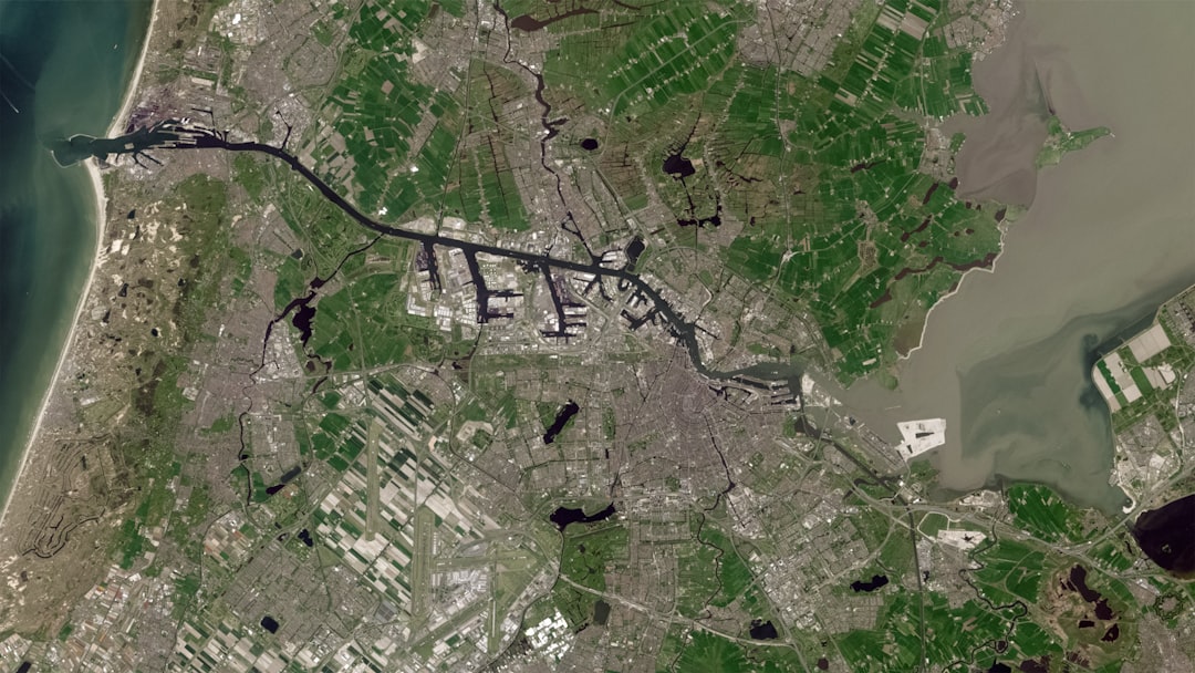
Recent in-depth analysis of publicly available NASA satellite imagery has brought to light a series of anomalies that warrant careful examination. While the agency’s contributions to scientific understanding are vast and undeniable, the discovery of what appear to be deliberate alterations in a selection of its photographic records raises significant questions regarding transparency and data integrity. This investigation, conducted by independent researchers and data analysts, focuses on photographic evidence spanning several decades, suggesting a pattern of selective enhancement and, in some instances, what could be interpreted as outright digital manipulation. The implications, if these findings are confirmed, could impact not only public perception of NASA’s work but also the scientific conclusions drawn from the compromised datasets.
Historical Context of NASA Imagery and Public Access
NASA has a long and storied history of utilizing satellite imagery to observe Earth and its celestial neighbors. From the early days of the Sputnik era to the cutting-edge capabilities of modern Earth observation satellites, these images have served as crucial tools for scientific research, environmental monitoring, and public education. The agency has largely operated with a commitment to making this data accessible to the public, fostering a spirit of open science and collaborative research. This accessibility has allowed countless individuals and institutions to build upon NASA’s findings, verify results, and develop innovative applications. However, this very accessibility also provides the raw material for independent scrutiny, and it is within this framework that the recent allegations have emerged.
The Evolution of Satellite Imaging Technology
The technological advancements in satellite imaging have been nothing short of remarkable. Early satellites captured images with limited resolution and spectral range. Over time, sensor technology has evolved dramatically, enabling the capture of increasingly detailed images across a broader spectrum of light, including infrared and ultraviolet. This evolution has allowed scientists to discern subtle differences in surface composition, temperature, and vegetation health, leading to groundbreaking discoveries in fields ranging from climate science to geology. The ability to gather such detailed information remotely has revolutionized our understanding of complex systems.
Early Missions and Their Photographic Legacy
Pioneering missions like Explorer 1 and the Ranger probes, while rudimentary by today’s standards, laid the groundwork for subsequent satellite imaging programs. The iconic images of Earth from space captured by the Apollo missions, though not strictly Earth observation satellites, ignited public imagination and demonstrated the profound perspective shift that space exploration offered. These early photographs, often black and white and of lower resolution, have a distinct aesthetic and historical significance.
The Era of Earth Observation Satellites
The launch of dedicated Earth observation satellites, such as the Landsat program, marked a turning point. These platforms provided continuous monitoring of Earth’s surface, generating vast archives of data that have been invaluable for tracking deforestation, urban sprawl, and changes in ice cover. The development of multispectral and hyperspectral imaging further enhanced the analytical capabilities of these datasets, allowing for more precise identification of different materials and environmental conditions.
NASA’s Stated Commitment to Data Transparency
NASA’s official policy and public statements consistently emphasize transparency and open access to scientific data. The agency’s websites and data portals are designed to facilitate the download and use of imagery and research findings. This commitment is crucial for maintaining public trust and fostering scientific progress. The narrative surrounding NASA’s data has generally been one of openness, with the agency actively encouraging the scientific community and the public to utilize its resources.
Open Data Initiatives and Archival Systems
NASA has invested significantly in digital archival systems to preserve and disseminate its vast photographic and scientific data. Initiatives like the Earthdata portal and the Planetary Data System (PDS) aim to make this information accessible and usable for researchers worldwide. These platforms are intended to be repositories of unadulterated scientific observation.
The Role of Peer Review and Scientific Validation
The scientific process inherently relies on peer review and validation. Researchers are expected to present their findings, including the data used, for scrutiny by their peers. Any data used in significant studies is typically subject to verification, and original data sources are often consulted to ensure the integrity of the research. This system, while not infallible, is crucial for identifying errors and questionable practices.
Recent discussions surrounding NASA satellite image tampering have gained traction, particularly in light of an article that delves into the implications of such actions on scientific integrity and public trust. This article highlights various instances where alterations to satellite imagery may have occurred, raising questions about transparency in data reporting. For more in-depth analysis and related findings, you can read the article at XFile Findings.
Emergence of Discrepancies: Initial Findings and Methodologies
The current scrutiny began with independent researchers and data enthusiasts meticulously comparing publicly released NASA images with their original source data, where available, or with images from different, independently verified sources captured around the same time. The initial findings suggest subtle but persistent discrepancies in color balance, contrast, and the presence or absence of specific features. These discrepancies, while potentially dismissible as standard image processing or minor variations, have become more pronounced when viewed in aggregate.
Comparative Analysis of Image Datasets
The core of the investigation involves a rigorous comparative analysis. Researchers have identified specific image sets, particularly those related to controversial or politically sensitive topics, where visual differences are discernible between versions. This analysis goes beyond simple visual inspection, often employing digital forensics techniques to detect alterations.
Identifying Color and Brightness Variations
One of the most frequently observed anomalies involves variations in color saturation and brightness. In some instances, researchers claim that images appear to have been digitally enhanced to such an extent that they may misrepresent the original scene. This can include artificially saturating colors to make features appear more prominent or altering brightness levels to obscure or highlight specific details. The degree of these alterations varies, but the consistency across a selection of images has raised flags.
Examining Resolution and Detail Preservation
Another area of focus is the preservation of detail. In some cases, alleged tampering appears to involve the smoothing or removal of fine details, such as atmospheric particles, cloud formations, or even geological features. This can lead to an artificially clean or idealized representation of a scene, potentially masking complex or nuanced atmospheric conditions or surface characteristics.
Digital Forensics Techniques Applied
To move beyond subjective visual observation, advanced digital forensics techniques are being employed. These methods aim to identify non-natural patterns or artifacts that would be indicative of digital manipulation.
Metadata Examination and Inconsistencies
The examination of image metadata can sometimes reveal inconsistencies or alterations in the EXIF data, which typically contains information about the camera, date, time, and other parameters of an image capture. While metadata can be modified, significant or unusual deviations can serve as red flags.
Pixel-Level Analysis for Artifacts
Pixel-level analysis involves scrutinizing individual pixels and groups of pixels for signs of digital artifacts. This can include looking for signs of resampling, interpolation, or the application of filters that would not naturally occur in an unaltered photographic capture. The presence of such artifacts, particularly in a systematic manner, can strongly suggest digital manipulation.
Specific Cases Under Scrutiny: Unpacking the Anomalies
While the investigation is ongoing, several specific instances have been highlighted by researchers as particularly noteworthy. These cases often involve images that have become iconic or have been used to support significant scientific or public narratives. The alleged alterations, in these instances, are not merely cosmetic but appear to have the potential to influence interpretation.
The Martian Surface: Unveiling Earthly Hues?
Perhaps one of the most discussed areas of concern involves images of the Martian surface. Critics allege that certain “colorized” images of Mars, while intended to enhance scientific understanding, have been manipulated in ways that deviate from the raw data. The discussion often centers on whether the color palettes deployed are overly representative of Earth-like conditions or are deliberately chosen to create a more aesthetically pleasing, and potentially misleading, depiction.
Colorization as Enhancement vs. Distortion
The practice of colorizing black-and-white or monochrome images is a standard scientific tool. However, the concern arises when the colorization process appears to introduce artificial colors or misrepresent the actual spectral reflectance of the Martian surface as captured by the rover’s instruments. The debate hinges on the ethical boundaries between enhancing visual appeal and distorting scientific accuracy.
Alleged Removal of Unwanted Artifacts
Some researchers have pointed to instances where what appear to be natural atmospheric phenomena or geological anomalies on Mars might have been digitally smoothed or removed in public-facing images. The argument is that this practice creates an overly sanitized and potentially less scientifically informative representation of the planet.
Earth Observation and Environmental Narratives
Images depicting Earth’s environmental changes have also come under examination. Critics suggest that in some instances, these images may have been subtly altered to emphasize certain trends or downplay others, potentially influencing public perception and policy debates.
Selective Exposure and Contrast Adjustments
Allegations have been made regarding the selective adjustment of contrast and exposure in images related to melting glaciers, deforestation, or pollution. The argument is that such adjustments could exaggerate the perceived extent of these phenomena or, conversely, diminish their visual impact, thereby influencing the narrative being conveyed.
Unprecedented Cloud Cover and Atmospheric Clarity
In some supposed “before and after” comparisons of Earth’s surface, alleged tampering includes the artificial removal or alteration of cloud cover and atmospheric haze to provide a seemingly clearer, but potentially unrepresentative, view of the underlying landscape. This raises questions about the fidelity of the presented imagery to actual atmospheric conditions at the time of capture.
Potential Motivations and Broader Implications
The question of why such alterations might have occurred, if confirmed, is multifaceted and speculative. The implications, however, are significant, touching upon scientific integrity, public trust, and the very foundation of knowledge derived from space-based observation.
The Role of Public Perception and Funding
NASA’s work is heavily reliant on public support and government funding. It is conceivable, though unproven, that a desire to present “striking” or “compelling” imagery for public consumption or to garner continued support might have incentivized certain forms of image enhancement that crossed ethical lines.
The “Wow Factor” in Public Outreach
Space exploration often benefits from images that capture the public’s imagination. The drive to produce visually stunning images for public outreach materials, educational programs, and general media consumption might, in some instances, have led to a blurring of the lines between artistic enhancement and scientific representation.
Securing Continued Investment and Support
A compelling visual narrative can be a powerful tool in advocating for continued investment in space programs. If certain images were subtly manipulated to underscore progress or urgency in areas like climate change research, this could be seen as a strategic, albeit ethically questionable, approach to securing funding.
Scientific Integrity and the Erosion of Trust
The most profound implication of confirmed image tampering would be the erosion of scientific integrity and public trust in NASA. If the very data used to derive scientific conclusions has been compromised, it calls into question the validity of those conclusions and the reliability of the agency as a source of objective information.
The Chain of Scientific Evidence
Scientific understanding is built upon a chain of evidence. If the foundational visual evidence, such as satellite imagery, is found to be unreliable, it can cast doubt on subsequent research, theoretical models, and policy decisions that relied upon that imagery. This can have ripple effects across numerous scientific disciplines.
The Importance of Unvarnished Truth in Science
Science thrives on the pursuit of unvarnished truth, even when that truth is complex or less aesthetically pleasing. The introduction of manipulation, however subtle, undermines this core principle and introduces bias into the scientific process.
Recent discussions surrounding NASA satellite image tampering have sparked significant interest among researchers and enthusiasts alike. A related article delves into the implications of such alterations and their potential impact on scientific integrity. For those curious about the broader context of this issue, you can read more in this insightful piece on image manipulation. This exploration not only highlights the technical aspects but also raises important questions about transparency in space exploration.
Moving Forward: Calls for Investigation and Protocol Review
The emergence of these allegations has led to calls for a thorough, independent investigation. Scientists, data integrity advocates, and members of the public are urging NASA to address these concerns transparently and decisively.
Demands for Independent Audits and Investigations
There is a growing demand for independent bodies to conduct comprehensive audits of NASA’s image processing protocols and to investigate the specific cases that have been highlighted. Such an investigation would need to be thorough, objective, and report its findings publicly.
Transparency in Image Processing Workflows
A crucial aspect of any investigation would be to examine NASA’s internal image processing workflows. Understanding the exact steps taken from raw data capture to final public release is essential for identifying potential points of manipulation and ensuring that appropriate safeguards are in place.
Establishing Clearer Guidelines for Image Enhancement
The findings from such an investigation could lead to the establishment of clearer, more stringent guidelines for image enhancement and colorization. These guidelines would need to strike a delicate balance between scientific representation and necessary visual enhancement for educational purposes.
Rebuilding Public Trust and Ensuring Future Integrity
Ultimately, the goal is to ensure the integrity of NASA’s data and to rebuild any eroded public trust. This will require a commitment to transparency, accountability, and a willingness to address concerns openly and honestly.
Public Release of Revised and Verified Datasets
If discrepancies are confirmed, NASA may need to issue revised versions of affected images, accompanied by clear explanations of the alterations and the scientific rationale behind any necessary modifications.
Enhanced Oversight and Data Verification Processes
Implementing enhanced oversight mechanisms and more robust data verification processes within NASA’s image dissemination channels will be critical. This could involve multiple layers of review and cross-validation with independent data sources before public release. The journey from initial anomaly detection to a comprehensive understanding and resolution of these allegations is ongoing. The scientific community and the public alike will be watching closely, seeking reassurance that the images shaping our understanding of Earth and the cosmos remain a testament to objectivity and truth.
FAQs
What is the NASA satellite image tampering evidence?
The NASA satellite image tampering evidence refers to the alleged manipulation or alteration of images captured by NASA’s satellites, which some individuals claim to have evidence of.
What are some examples of alleged tampering in NASA satellite images?
Some examples of alleged tampering in NASA satellite images include the presence of anomalies or inconsistencies in the images, such as unusual shapes, blurred areas, or discrepancies in the visual data.
What are the implications of tampering with NASA satellite images?
The implications of tampering with NASA satellite images could include the distortion of scientific data, the spread of misinformation, and the undermining of public trust in the accuracy and reliability of NASA’s research and findings.
How does NASA respond to allegations of image tampering?
NASA typically responds to allegations of image tampering by providing explanations for the anomalies or discrepancies in the images, citing technical issues, natural phenomena, or limitations of the imaging technology as the reasons behind the perceived tampering.
What measures does NASA take to ensure the integrity of its satellite images?
NASA employs rigorous quality control processes, calibration procedures, and data validation methods to ensure the integrity and accuracy of its satellite images. Additionally, NASA makes its raw image data publicly available for independent analysis and verification.