Real-time satellite tracking represents a critical technological capability that provides continuous monitoring and data collection from Earth-orbiting satellites. This technology enables the immediate observation and analysis of terrestrial phenomena, supporting applications across multiple sectors including environmental science, agriculture, disaster management, and national security operations. The technology functions by utilizing networks of ground-based tracking stations and communication systems that maintain constant contact with satellites, allowing for the continuous transmission of observational data.
This real-time data flow facilitates rapid response capabilities for time-sensitive situations such as natural disasters, environmental emergencies, and security threats. The immediate availability of satellite imagery and sensor data enables decision-makers to assess situations as they develop and implement appropriate responses without the delays associated with traditional data collection methods. Real-time satellite tracking systems support long-term monitoring and analysis programs essential for scientific research and policy development.
Urban development patterns, deforestation rates, agricultural productivity, and climate change indicators can be tracked continuously, providing researchers and planners with comprehensive datasets for trend analysis and predictive modeling. Agricultural applications include crop monitoring, irrigation management, and yield prediction, while environmental applications encompass forest fire detection, flood monitoring, and pollution tracking. The technology also supports infrastructure monitoring, including transportation networks, power grids, and communication systems, contributing to improved maintenance scheduling and operational efficiency across various industries.
Key Takeaways
- Real time satellite tracking is crucial for accurate monitoring and timely response to global events.
- Satellites use advanced sensors and communication systems to provide continuous Earth observation.
- Applications range from environmental monitoring and disaster management to security and navigation.
- Technological advancements enhance tracking precision but raise ethical and privacy concerns.
- International collaboration is essential for effective satellite monitoring and addressing global challenges.
How Real Time Satellite Tracking Works
The mechanics of real-time satellite tracking involve a complex interplay of technology, data processing, and communication systems. Satellites equipped with advanced sensors orbit the Earth, capturing vast amounts of data related to various phenomena. These sensors can detect everything from weather patterns to changes in land use, depending on their design and purpose.
Once the data is collected, it is transmitted back to ground stations where it undergoes processing and analysis. This information is then made available to users in real time through various platforms, including web applications and mobile devices. The integration of Global Navigation Satellite Systems (GNSS) further enhances the accuracy of real-time tracking.
GNSS provides precise location data that can be used to track moving objects, such as vehicles or wildlife. By combining GNSS data with satellite imagery and other sensor inputs, users can obtain a comprehensive view of their area of interest. This multi-faceted approach not only improves the accuracy of tracking but also allows for the integration of historical data, enabling users to identify trends and make predictions based on past behaviors.
The Role of Satellites in Monitoring Earth
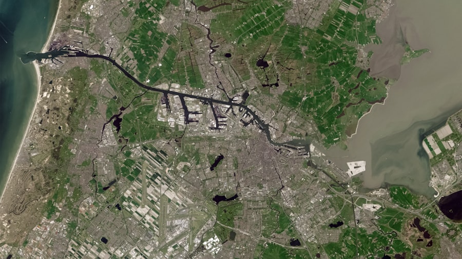
Satellites play an indispensable role in monitoring the Earth’s environment and human activities. They serve as eyes in the sky, providing a unique vantage point that is unattainable through ground-based observations alone. This capability is particularly valuable for monitoring large-scale phenomena such as deforestation, urbanization, and climate change.
By capturing high-resolution images and data over time, satellites enable scientists and policymakers to understand the dynamics of these processes and their implications for ecosystems and human societies. In addition to environmental monitoring, satellites are crucial for disaster response and management. They provide real-time data during natural disasters such as hurricanes, floods, and wildfires, allowing emergency responders to assess damage and coordinate relief efforts effectively.
The ability to visualize affected areas from space can significantly enhance situational awareness, enabling quicker and more efficient responses that can ultimately save lives. Thus, satellites not only contribute to our understanding of the Earth but also play a vital role in safeguarding communities against various threats.
Applications of Real Time Satellite Tracking
The applications of real-time satellite tracking are vast and varied, spanning multiple sectors including agriculture, transportation, environmental science, and national security. In agriculture, farmers utilize satellite data to monitor crop health, optimize irrigation practices, and manage resources more efficiently. By analyzing real-time information about soil moisture levels and weather conditions, farmers can make informed decisions that enhance yield while minimizing waste.
In the transportation sector, real-time satellite tracking is revolutionizing logistics and supply chain management. Companies can track shipments in transit, monitor vehicle locations, and optimize routes based on current traffic conditions. This not only improves efficiency but also reduces costs associated with delays and fuel consumption.
Furthermore, in the realm of national security, real-time satellite tracking is essential for surveillance and reconnaissance operations. Governments rely on satellite imagery to monitor borders, track military movements, and assess potential threats, underscoring the technology’s critical role in maintaining national safety.
Advancements in Satellite Technology
| Metric | Description | Typical Value | Unit |
|---|---|---|---|
| Update Frequency | How often the satellite position data is refreshed | 1-10 | seconds |
| Positional Accuracy | Accuracy of the satellite’s reported position | 1-10 | meters |
| Latency | Delay between satellite observation and data availability | 0.5-5 | seconds |
| Tracking Range | Maximum distance from ground station for reliable tracking | 2000-4000 | kilometers |
| Number of Satellites Tracked | Count of satellites simultaneously tracked in real time | 10-1000+ | units |
| Data Throughput | Amount of tracking data transmitted per second | 1-100 | kilobits per second (kbps) |
| Orbital Types Supported | Types of satellite orbits tracked (LEO, MEO, GEO) | LEO, MEO, GEO | categories |
The field of satellite technology has witnessed remarkable advancements over recent years, driven by innovations in materials science, miniaturization, and data processing capabilities. Modern satellites are now equipped with sophisticated sensors that can capture high-resolution images with unprecedented clarity. These advancements have made it possible to monitor even the most subtle changes on Earth’s surface, providing invaluable insights for researchers and decision-makers alike.
Additionally, the rise of small satellites or CubeSats has democratized access to satellite technology. These compact satellites are cost-effective to build and launch, allowing smaller organizations and even universities to participate in satellite missions. This proliferation of satellite technology has led to an increase in the volume of data available for analysis, fostering collaboration among researchers worldwide.
As technology continues to evolve, the potential applications for real-time satellite tracking will expand even further, paving the way for innovative solutions to global challenges.
Challenges in Real Time Satellite Tracking
Despite its numerous advantages, real-time satellite tracking faces several challenges that must be addressed to maximize its potential. One significant issue is the sheer volume of data generated by satellites. While having access to vast amounts of information is beneficial, processing this data efficiently poses a considerable challenge.
Organizations must invest in advanced data analytics tools and infrastructure to ensure that they can derive actionable insights from the information collected. Another challenge lies in the limitations imposed by satellite coverage and resolution. While many regions are well-served by existing satellite networks, there are still areas where coverage is sparse or non-existent.
Additionally, factors such as weather conditions can affect the quality of satellite imagery. Cloud cover or atmospheric interference can obscure important details that are crucial for accurate monitoring. Addressing these challenges requires ongoing investment in technology development and international collaboration to enhance global satellite networks.
Environmental Benefits of Satellite Monitoring
The environmental benefits of satellite monitoring are profound and far-reaching. By providing comprehensive data on land use changes, deforestation rates, and water quality, satellites enable researchers to track environmental trends over time. This information is essential for understanding the impacts of human activities on ecosystems and for developing strategies aimed at conservation and sustainability.
Moreover, satellites play a critical role in climate change research by monitoring greenhouse gas emissions and assessing changes in ice cover and sea levels. This data is vital for informing policy decisions aimed at mitigating climate change effects. Additionally, real-time satellite tracking can aid in biodiversity conservation efforts by identifying critical habitats and monitoring endangered species’ movements.
By leveraging satellite technology for environmental monitoring, stakeholders can make informed decisions that promote ecological balance and protect natural resources for future generations.
Real Time Satellite Tracking in Disaster Management
Real-time satellite tracking has become an indispensable tool in disaster management efforts worldwide. During natural disasters such as hurricanes or earthquakes, satellites provide crucial information that helps emergency responders assess damage quickly and accurately. High-resolution imagery allows for the identification of affected areas, enabling targeted relief efforts that can reach those most in need.
Furthermore, satellites play a vital role in disaster preparedness by providing early warning systems that can predict severe weather events or geological activity. By analyzing real-time data on atmospheric conditions or seismic activity, authorities can issue timely alerts that save lives and minimize property damage. The integration of satellite technology into disaster management frameworks enhances resilience against natural hazards and fosters a proactive approach to risk reduction.
Future Trends in Satellite Tracking
As technology continues to advance at a rapid pace, several trends are emerging in the field of satellite tracking that promise to reshape its future landscape. One notable trend is the increasing use of artificial intelligence (AI) and machine learning algorithms to analyze satellite data more efficiently. These technologies can automate data processing tasks, identify patterns within large datasets, and generate predictive models that enhance decision-making capabilities.
Another trend is the growing emphasis on sustainability within the satellite industry itself. As concerns about space debris rise alongside the proliferation of satellites in orbit, companies are exploring innovative solutions for debris mitigation and sustainable satellite design.
International Collaboration in Satellite Monitoring
International collaboration plays a crucial role in enhancing the effectiveness of satellite monitoring efforts across borders. Many global challenges—such as climate change, natural disasters, and food security—require coordinated responses that transcend national boundaries. Collaborative initiatives allow countries to share data resources, expertise, and best practices in satellite technology application.
Organizations like the United Nations Office for Outer Space Affairs (UNOOSA) facilitate international cooperation by promoting access to space-based technologies for developing nations. Such partnerships enable countries with limited resources to benefit from advanced satellite monitoring capabilities while contributing their unique perspectives on local challenges. Through collaborative efforts, nations can work together towards common goals that address pressing global issues effectively.
The Ethical and Privacy Considerations of Satellite Tracking
As real-time satellite tracking becomes increasingly prevalent, ethical considerations surrounding privacy and surveillance come to the forefront of discussions about its use. The ability to monitor individuals or groups from space raises significant questions about consent and civil liberties. While satellites serve essential functions in areas like disaster response or environmental monitoring, their potential misuse for intrusive surveillance poses ethical dilemmas that must be carefully navigated.
To address these concerns, policymakers must establish clear guidelines governing the use of satellite technology while balancing security needs with individual rights. Transparency regarding how data is collected and used is essential for building public trust in satellite monitoring initiatives. Engaging stakeholders—including communities affected by surveillance—can foster dialogue around ethical practices that respect privacy while harnessing the benefits offered by real-time satellite tracking technologies.
In conclusion, real-time satellite tracking represents a transformative force across various sectors by providing critical insights into our planet’s dynamics while enhancing decision-making capabilities during emergencies or long-term planning efforts alike. As advancements continue apace alongside emerging challenges related to ethics or sustainability arise—ongoing collaboration among nations will be vital for maximizing its potential responsibly while ensuring equitable access for all stakeholders involved.
Real-time satellite tracking has become an essential tool for various applications, from environmental monitoring to disaster response. For those interested in exploring this topic further, you can read a related article that delves into the advancements and implications of satellite technology in our daily lives. Check it out here: Real-Time Satellite Tracking Insights.
WATCH THIS! 🛰️125 Years of Hidden Signals: What NASA Just Admitted About the Black Knight Satellite
FAQs
What is real-time satellite tracking?
Real-time satellite tracking refers to the continuous monitoring and display of the current position and trajectory of satellites as they orbit the Earth. This allows users to see where a satellite is located at any given moment.
How does real-time satellite tracking work?
Real-time satellite tracking uses data from ground-based radar, radio signals, and onboard satellite telemetry to calculate the satellite’s orbit and position. This information is then processed and displayed on tracking software or websites.
What are the common uses of real-time satellite tracking?
Real-time satellite tracking is used for various purposes including weather forecasting, communication, navigation, scientific research, military surveillance, and space mission monitoring.
Can anyone access real-time satellite tracking data?
Many real-time satellite tracking services are publicly available online, allowing anyone to view the positions of certain satellites. However, some military or classified satellites may not be accessible to the public.
What types of satellites can be tracked in real time?
Most Earth-orbiting satellites, including weather satellites, communication satellites, GPS satellites, and the International Space Station (ISS), can be tracked in real time.
What tools or software are used for real-time satellite tracking?
There are various tools and software available, such as websites like Heavens-Above, apps like Satellite Tracker, and professional software like STK (Systems Tool Kit) that provide real-time satellite tracking capabilities.
How accurate is real-time satellite tracking?
The accuracy of real-time satellite tracking depends on the quality of tracking data and algorithms used. Generally, it can provide position information accurate to within a few kilometers or better.
Does real-time satellite tracking require special equipment?
To view real-time satellite tracking data, no special equipment is needed beyond a computer or smartphone with internet access. However, tracking satellites using radio signals or radar requires specialized ground stations.
Are there any privacy concerns with real-time satellite tracking?
While satellite tracking data is generally public, concerns may arise regarding the tracking of private or sensitive satellites. However, most tracking services only provide orbital data without detailed imagery or sensitive information.
How often is real-time satellite tracking data updated?
Real-time satellite tracking data is typically updated every few seconds to minutes, depending on the tracking system and satellite type, to provide near-instantaneous position information.