
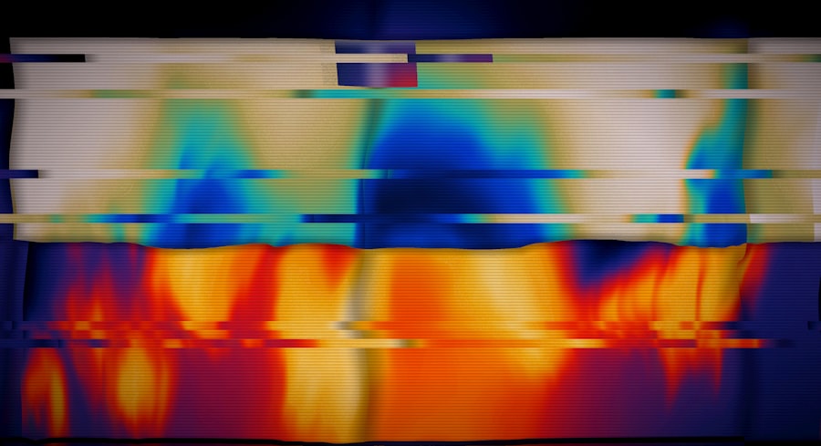
Satellite thermal imagery captures infrared radiation emitted by Earth’s surface and converts it into visual representations of temperature variations across different terrains. This technology functions based on the physical principle that all objects emit thermal radiation proportional to their temperature, as described by Planck’s law of black-body radiation. Satellites equipped with thermal sensors detect this emitted radiation and generate thermal maps showing temperature distributions across extensive geographical areas.
These images serve multiple practical purposes, including environmental monitoring, urban planning, and disaster management operations. Thermal imagery data is commonly displayed using false-color visualization, where specific color schemes represent different temperature ranges. This color-coding system enables rapid identification of temperature anomalies, such as urban heat islands or land surface temperature variations caused by different agricultural practices.
Continuous monitoring of temperature changes through time-series thermal imagery provides valuable data for analyzing climate patterns, tracking land use modifications, and assessing ecosystem health. Ongoing technological developments continue to enhance the spatial resolution and measurement accuracy of thermal imagery systems, establishing this technology as a fundamental tool for scientific research and policy decision-making processes.
Key Takeaways
- Satellite thermal imagery provides critical temperature data for diverse environmental and land use applications.
- Proper commissioning and quality control are essential to ensure accurate and reliable thermal imagery data.
- Selecting the appropriate satellite depends on the specific resolution, coverage, and spectral requirements of the project.
- Thermal imagery is invaluable for monitoring environmental changes, agricultural health, and managing disaster response efforts.
- Advances in satellite technology will expand the capabilities and applications of thermal imagery in the future.
The Importance of Commissioning Satellite Thermal Imagery
Commissioning satellite thermal imagery is a crucial step in ensuring that the data collected meets specific research or operational needs. This process involves defining the objectives of the imagery acquisition, selecting appropriate satellite platforms, and determining the necessary specifications for the thermal sensors. By carefully commissioning thermal imagery, organizations can ensure that they obtain high-quality data that is relevant to their specific applications, whether it be for environmental monitoring, urban planning, or disaster response.
Moreover, commissioning satellite thermal imagery allows stakeholders to align their data collection efforts with broader scientific and policy goals. For instance, in the context of climate change research, accurately capturing temperature variations can help scientists understand the impacts of global warming on different ecosystems. Similarly, urban planners can utilize thermal imagery to identify areas that require intervention to mitigate heat-related health risks.
By establishing clear objectives and specifications during the commissioning phase, organizations can maximize the utility of the thermal imagery they acquire.
Selecting the Right Satellite for Thermal Imagery Commissioning
Choosing the appropriate satellite for thermal imagery commissioning is a multifaceted decision that hinges on several factors, including spatial resolution, temporal frequency, and sensor capabilities. Different satellites offer varying levels of detail and revisit times, which can significantly impact the quality and applicability of the thermal data collected. For instance, high-resolution satellites like Landsat or Sentinel-2 provide detailed imagery suitable for localized studies, while broader coverage satellites like MODIS are better suited for regional or global assessments.
In addition to resolution and frequency, it is essential to consider the specific capabilities of the thermal sensors onboard the satellites. Some sensors may be optimized for detecting specific temperature ranges or may have advanced features such as multi-spectral capabilities that allow for more nuanced analysis. Understanding these technical specifications is vital for ensuring that the selected satellite aligns with the intended application of the thermal imagery.
Engaging with experts in remote sensing can provide valuable insights into which satellite platforms are best suited for particular research questions or operational needs.
Preparing for Satellite Thermal Imagery Commissioning
Preparation for commissioning satellite thermal imagery involves several critical steps that ensure a smooth data acquisition process. Initially, stakeholders must define their objectives clearly and identify the specific geographic areas of interest. This involves conducting preliminary research to understand the environmental conditions and potential temperature variations within those areas.
Additionally, stakeholders should consider any logistical challenges that may arise during data collection, such as cloud cover or seasonal variations that could affect thermal readings. Once objectives and geographic areas are established, it is essential to develop a detailed commissioning plan that outlines the timeline, budget, and required resources for acquiring the thermal imagery. This plan should also include contingency measures to address potential issues that may arise during data collection.
Engaging with satellite operators or remote sensing experts during this phase can provide valuable guidance on best practices and help ensure that all necessary preparations are made to facilitate successful data acquisition.
Conducting Quality Control Checks for Satellite Thermal Imagery
| Metric | Description | Typical Value/Range | Unit | Notes |
|---|---|---|---|---|
| Spatial Resolution | Size of the smallest object that can be detected | 30 – 100 | meters | Depends on satellite sensor and altitude |
| Thermal Sensitivity (NETD) | Noise Equivalent Temperature Difference, sensor’s ability to detect temperature differences | 0.05 – 0.2 | Kelvin | Lower values indicate higher sensitivity |
| Calibration Accuracy | Accuracy of temperature measurements after calibration | ±0.5 – ±2.0 | Kelvin | Depends on calibration method and conditions |
| Radiometric Resolution | Number of temperature levels sensor can distinguish | 12 – 16 | bits | Higher bits allow finer temperature gradations |
| Swath Width | Width of the ground area imaged in one pass | 50 – 300 | kilometers | Varies by satellite orbit and sensor design |
| Commissioning Duration | Time taken to complete commissioning phase | 2 – 6 | weeks | Includes sensor testing, calibration, and validation |
| Data Latency | Time from image capture to data availability | Minutes to hours | time | Depends on ground station and processing pipeline |
| Temperature Range | Range of temperatures sensor can accurately measure | -50 to 150 | °C | Typical for Earth observation thermal sensors |
Quality control checks are an integral part of the satellite thermal imagery commissioning process, ensuring that the data collected meets established standards for accuracy and reliability. These checks typically involve a series of validation steps designed to assess both the technical performance of the thermal sensors and the integrity of the acquired imagery. For instance, calibration procedures may be employed to adjust sensor readings based on known temperature references, ensuring that the data accurately reflects surface temperatures.
In addition to technical validation, visual inspections of the thermal imagery can help identify any anomalies or artifacts that may compromise data quality. This includes checking for issues such as cloud cover interference or sensor malfunctions that could distort temperature readings. By implementing rigorous quality control measures throughout the data acquisition process, organizations can enhance their confidence in the reliability of the thermal imagery and its subsequent analyses.
Processing and Analyzing Satellite Thermal Imagery Data
Once satellite thermal imagery has been acquired and validated, it undergoes a series of processing steps to prepare it for analysis. This typically involves converting raw sensor data into usable formats through techniques such as radiometric correction and atmospheric correction. Radiometric correction adjusts for sensor-specific biases and ensures that temperature readings are consistent across different images, while atmospheric correction accounts for atmospheric interference that may affect thermal readings.
After processing, analysts can employ various techniques to extract meaningful insights from the thermal imagery data. This may include statistical analyses to identify trends in temperature variations over time or spatial analyses to assess how land use changes impact local climates. Advanced machine learning algorithms can also be applied to classify land cover types based on temperature patterns or predict future temperature scenarios under different climate models.
The ability to analyze processed thermal imagery data effectively is crucial for deriving actionable insights that inform decision-making across various sectors.
Interpreting Satellite Thermal Imagery for Various Applications
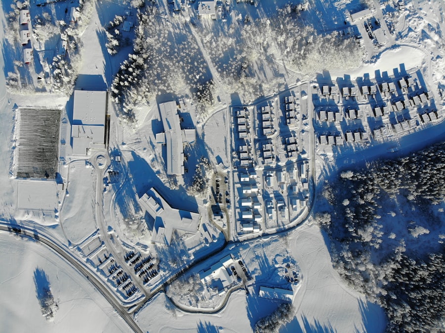
Interpreting satellite thermal imagery requires a nuanced understanding of both the technical aspects of remote sensing and the specific context in which the data will be applied. For example, in urban environments, analysts may focus on identifying heat islands—areas where temperatures are significantly higher than surrounding regions due to human activities and infrastructure. By analyzing thermal patterns over time, urban planners can develop strategies to mitigate heat-related health risks and improve overall livability in cities.
In agricultural contexts, interpreting thermal imagery can provide insights into crop health and irrigation needs. Variations in surface temperatures can indicate water stress or disease presence in crops, allowing farmers to make informed decisions about resource allocation and management practices. Additionally, land use planners can utilize thermal data to assess how different land cover types influence local climates and biodiversity.
The versatility of satellite thermal imagery makes it applicable across a wide range of fields, each requiring tailored interpretation methods to extract relevant information.
Leveraging Satellite Thermal Imagery for Environmental Monitoring
Satellite thermal imagery plays a pivotal role in environmental monitoring by providing critical data on temperature variations across diverse ecosystems. This information is essential for understanding how climate change impacts natural habitats and biodiversity. For instance, researchers can use thermal imagery to monitor changes in surface temperatures in sensitive areas such as wetlands or forests, helping to identify potential threats from rising temperatures or altered precipitation patterns.
Moreover, satellite thermal imagery can aid in tracking phenomena such as glacial melt or sea surface temperature changes in oceans. By analyzing long-term trends in these datasets, scientists can gain insights into broader climate patterns and their implications for global ecosystems.
Utilizing Satellite Thermal Imagery for Agricultural and Land Use Applications
In agriculture, satellite thermal imagery serves as a powerful tool for optimizing resource management and enhancing crop yields.
This proactive approach enables targeted irrigation practices that conserve water while ensuring crops receive adequate moisture during critical growth periods.
Additionally, land use applications benefit from satellite thermal imagery by providing insights into how different land cover types interact with local climates. For example, urbanization often leads to increased surface temperatures due to impervious surfaces like asphalt and concrete. By analyzing these temperature variations through thermal imagery, planners can develop strategies to incorporate green spaces or reflective materials into urban designs to mitigate heat effects.
The integration of satellite thermal imagery into agricultural and land use practices not only enhances productivity but also promotes sustainable resource management.
Integrating Satellite Thermal Imagery into Disaster Response and Management
The integration of satellite thermal imagery into disaster response efforts has revolutionized how organizations assess and respond to emergencies such as wildfires, floods, or hurricanes. During wildfires, for instance, thermal sensors can detect hotspots and monitor fire progression in real-time, providing critical information to firefighting teams on where to allocate resources most effectively. This timely data can significantly enhance situational awareness and improve response strategies.
In flood scenarios, satellite thermal imagery can help assess damage by identifying areas where water has inundated land surfaces. By analyzing temperature differences between flooded regions and surrounding areas, responders can prioritize rescue operations and resource distribution based on real-time conditions. The ability to leverage satellite thermal imagery during disasters not only enhances response efficiency but also contributes to more effective recovery efforts by providing insights into long-term impacts on affected communities.
Future Developments and Applications of Satellite Thermal Imagery
The future of satellite thermal imagery holds exciting potential as advancements in technology continue to evolve. Emerging trends include increased sensor resolution and improved algorithms for data processing and analysis. As new satellites are launched with enhanced capabilities—such as hyperspectral sensors—researchers will gain access to more detailed information about surface temperatures and material properties across various landscapes.
Furthermore, integrating artificial intelligence (AI) with satellite thermal imagery analysis promises to unlock new applications across multiple sectors. AI algorithms can automate pattern recognition processes within large datasets, enabling faster identification of trends or anomalies that may require attention. As these technologies converge, we can expect even more innovative uses for satellite thermal imagery in fields ranging from environmental science to urban planning and disaster management.
The ongoing development of satellite constellations designed specifically for Earth observation will also enhance our ability to monitor global changes in real-time. With improved temporal resolution and coverage capabilities, stakeholders will be better equipped to address pressing challenges such as climate change adaptation and resource management on a global scale. As we look ahead, it is clear that satellite thermal imagery will continue to play an integral role in shaping our understanding of Earth’s dynamic systems and informing sustainable practices across various domains.
Satellite thermal imagery commissioning is a crucial process that ensures the accuracy and reliability of thermal data collected from space. For a deeper understanding of the methodologies and best practices involved in this process, you can refer to a related article that discusses various aspects of satellite imagery and its applications. For more information, visit this article.
FAQs
What is satellite thermal imagery commissioning?
Satellite thermal imagery commissioning is the process of testing, calibrating, and validating a satellite’s thermal imaging instruments after launch to ensure they operate correctly and provide accurate temperature data.
Why is commissioning important for satellite thermal imagery?
Commissioning is crucial because it verifies the performance of thermal sensors, corrects any initial anomalies, and ensures the data collected meets the required quality standards for scientific, environmental, or military applications.
What are the typical steps involved in satellite thermal imagery commissioning?
Typical steps include instrument activation, calibration using onboard or external references, performance verification through test imaging, data analysis, and adjustments to sensor settings or algorithms as needed.
How long does the commissioning phase usually take?
The commissioning phase can vary but generally lasts from a few weeks to several months, depending on the complexity of the satellite and its instruments.
What types of calibration are performed during commissioning?
Calibration may include radiometric calibration to ensure accurate temperature readings, geometric calibration to correct spatial distortions, and spectral calibration to verify sensor response across thermal wavelengths.
Who is responsible for satellite thermal imagery commissioning?
Commissioning is typically conducted by the satellite manufacturer, mission operations team, and scientific users who collaborate to validate instrument performance and data quality.
What challenges are commonly faced during satellite thermal imagery commissioning?
Challenges include sensor degradation, unexpected instrument behavior, environmental factors affecting calibration, and the need to adjust algorithms to compensate for in-orbit conditions.
How is the accuracy of thermal imagery verified during commissioning?
Accuracy is verified by comparing satellite data with ground-based measurements, using onboard calibration targets, and cross-referencing with data from other satellites or instruments.
Can satellite thermal imagery commissioning be repeated after the initial phase?
Yes, periodic recalibration and validation can be performed throughout the satellite’s operational life to maintain data accuracy and compensate for sensor aging or environmental changes.
What applications benefit from properly commissioned satellite thermal imagery?
Applications include weather forecasting, climate monitoring, wildfire detection, urban heat mapping, agriculture management, and military surveillance.